
Our Projects
SHARJAH HISTORIC SITES
HERITAGE & ARCHAEOLOGY
The project
Recording the ancient properties and remaining of their old culture to present attractions for tourism, research and studies, identification, and analysis.
The mission
GEOTECH3D is Committed to working with the Department of Culture Government of Sharjah with an aerial survey of their cultural heritage sites to determine an identification of current strength and measurement, and it also helps them understand the masterplan of the area.
The Execution
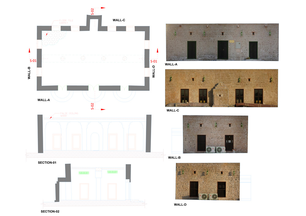
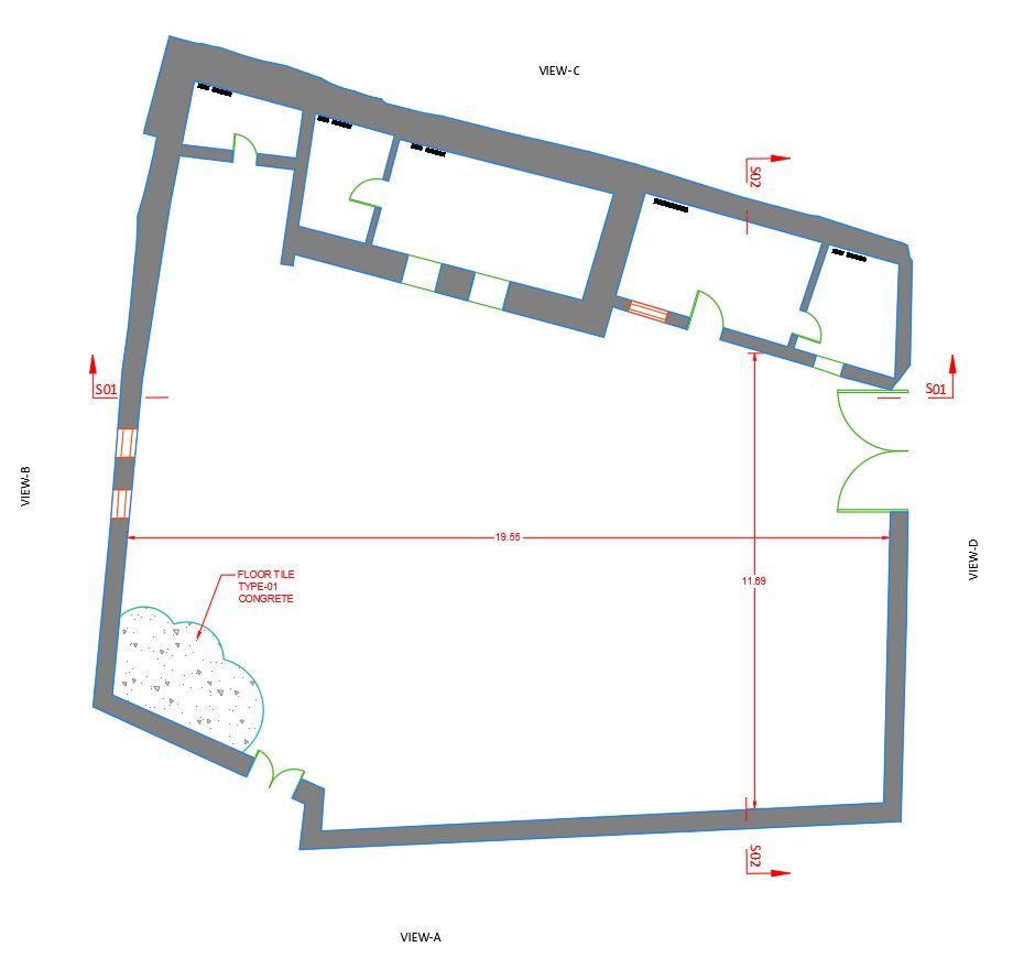
Geotech 3D has established GCP and an Aerial survey of the entire area using a heavy-lifting Multirotor drone to produce high-quality orthophotos using up-to-date, high-end GIS software. Then we digitize features like building boundary parcel boundaries and other features, adding attribute details on each element regarding the client’s information. Meanwhile, 3D laser scanning work was conducted for 3D documentation.
Output
- 3D Realistic Mesh
- GIS Database
- CAD drawings
- Walkthrough
- Survey report
Search Now
Error: Contact form not found.