

Our Services
GIS data integration for government and connected public services
A permit, a utility record and a public service request can all describe the same place yet sit in separate systems. GIS data integration for government connects geospatial information with agency data and workflows, giving staff location context for planning, reviews and service delivery. In Abu Dhabi, the Spatial Data Infrastructure Program aims to facilitate geospatial data sharing, make high-quality data available and help government entities develop GeoSmart services.
Connecting systems is only part of the work. Information also needs consistent location references, useful metadata and a clear path into staff decisions. When these elements align, teams can bring maps, records and operational processes together instead of treating each dataset as an isolated resource.
This article explains how public agencies can integrate geospatial data with legacy systems, support collaboration across departments and make location information useful to staff and the public. It also covers practical applications, including permit review, infrastructure management and emergency response, in the UAE context.
Key Takeaways
- See how combining location data with agency workflows can support planning, permit review, infrastructure management and public services.
- Learn what helps CAD files, spreadsheets and legacy systems work together, from consistent location references to reliable data exchange.
- Understand how enterprise GIS can support collaboration across departments while clarifying how data is maintained and shared.
- Explore ways to make maps and location information more useful to staff, citizens, contractors and reviewers.
- Identify where GIS and surveying services can support better-quality geospatial data for connected public services in the UAE.
How to use geospatial data integration in public services?
For public services, geospatial integration links location data with agency records and workflows. In the UAE, shared geographic information can help departments coordinate planning, reviews, asset management and public-facing services.
Shared Geospatial Data Across Departments
Shared geospatial data is location-based information that departments can access and use through agreed systems and rules. Planning teams, for example, can view zoning boundaries alongside transport and environmental layers. Infrastructure teams can connect asset locations with maintenance records. A shared platform gives leaders a consistent geographic reference for decisions and helps prevent conflicting map versions across departments.
Abu Dhabi’s Spatial Data Infrastructure Program aims to facilitate geospatial data sharing, improve access to high-quality information and help government entities develop GeoSmart services. Shared access is useful when an application, public asset or service area crosses departmental responsibilities. Clear ownership, update schedules and access permissions help departments use common data while remaining accountable for their own records.
Geospatial Data Quality and Governance
Geospatial data governance defines who maintains a dataset, how it is described and how others can use it. Quality checks can assess geometry, metadata completeness and usage patterns. Before another department relies on a road layer, for example, it needs consistent coordinates, a named custodian and a recorded update date.
These checks matter because an inaccurate boundary can affect a permit review, while missing metadata can make a useful layer difficult to interpret. Government teams can improve quality through ongoing user feedback and scheduled review. The United Nations Sustainable Development Goals comprise 17 goals and include 169 targets, according to the United Nations. The United Nations global indicator framework includes 234 unique indicators, offering a structured example of how shared definitions support consistent reporting.
Government GIS Platforms and Integration Tools
Government GIS platforms manage, analyse and display geographic information; integration tools connect them with other systems. Enterprise GIS supports mapped data and analysis, while cloud platforms can provide shared access and scalable storage. APIs exchange records between applications, and transformation tools help align fields and formats. The UAE Environmental Geospatial Platform is one example, focused on environmental and agricultural spatial data.
Cloud Optimized GeoTIFF and GeoParquet are cloud-friendly formats that support flexible access and querying. The right combination depends on existing systems, data volume, access needs and staff workflows. Integration costs can include software licensing, migration, interfaces, cloud hosting, security and ongoing maintenance. These factors shape the total investment, so no single cost applies to every government program.
Integrating Data from Legacy Systems
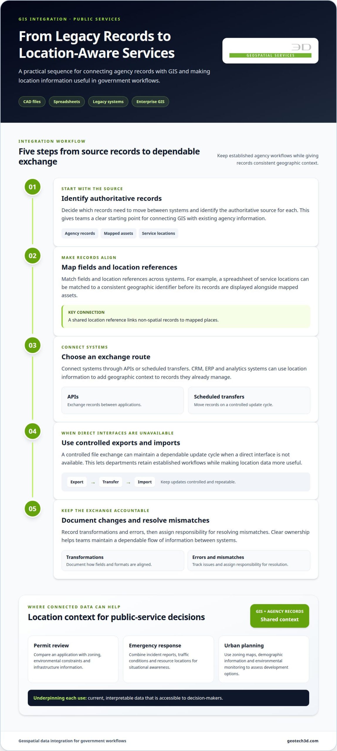
Agencies can integrate GIS with legacy systems by identifying authoritative records, mapping fields and location references, then connecting systems through APIs or scheduled transfers. For example, a spreadsheet of service locations can be matched to a consistent geographic identifier before its records are displayed alongside mapped assets.
CRM, ERP and analytics systems can use location information to add geographic context to non-spatial records. When direct interfaces are unavailable, controlled exports and imports can maintain a dependable update cycle. Teams should document transformations and errors, then assign responsibility for resolving mismatches. This lets departments retain established workflows while making location data more useful.
Connected data can support specific public-service tasks. Permit reviewers can compare an application with zoning, environmental constraints and infrastructure information. Emergency teams can combine incident reports, traffic conditions and resource locations for situational awareness. Urban planners can use zoning maps, demographic information and environmental monitoring to assess development options. Each use depends on current, interpretable data that is accessible to decision-makers.
Connecting CAD files, spreadsheets, and legacy systems
A government geographic information system is more useful when it connects spatial records with everyday agency workflows. Integration planning starts by identifying which records need to move between systems and how staff will use them.
Interoperability with Enterprise Systems
Interoperability lets GIS exchange location-linked records with CRM, ERP and analytics systems. Departments gain geographic context for information they already manage, such as linking a service request to an asset or parcel.
For example, a maintenance record in an ERP can be linked to an asset location, while CRM requests can be grouped by service area. Integration can replace repeated exports with record updates through APIs. Reported government examples show asset-data accuracy rising from about 74% to more than 98% with API integration. Results depend on data definitions and implementation quality.
Evaluating Workflows and System Integration
Workflow evaluation reveals where staff re-enter, transfer or reconcile information across applications. A permit review, for instance, may involve CAD drawings, spreadsheet registers and a case-management system. Mapping each handoff shows where location identifiers differ, records become outdated or teams need to resolve discrepancies.
Agencies can then prioritize interfaces around high-value tasks instead of connecting every system at once. Reported API integration examples show manual cross-system transfer work reduced by 70-85% in government environments. A useful assessment also considers reviewer time spent switching systems, data ownership and update frequency.
Planning GIS Integration Projects
Planning and implementation begin with a system inventory, workflow review and defined data requirements. Teams then map fields and geographic identifiers, select an exchange method, test representative records, and deploy and monitor the connection. The key is to align systems around a clear use case before expanding the integration.
For a national or local dataset, document which system is authoritative for each field. Bayanat, the UAE national data portal, publishes geospatial and GIS datasets. Agencies can use relevant datasets as inputs while retaining clear ownership of operational records and documenting any transformations.
CAD files need particular attention because drawing layers, coordinate references and asset labels can differ between projects. A road alignment in a CAD file, for example, can be aligned with GIS features before its attributes are linked to a spreadsheet or ERP record. Preserve the source file, record conversion rules and review sample features for shifted geometry or missing attributes.
For property records, linking spatial boundaries with structured ownership information provides a related application. Explore real estate strata services as a way to understand how property information can be organized spatially.
Enterprise GIS and interagency collaboration
Enterprise GIS gives departments a shared environment for managing and using geographic information across government. In the UAE, Abu Dhabi’s Spatial Data Infrastructure Program aims to strengthen the development, engagement and organisation of its SDI community. This matters when infrastructure, environmental and service data crosses agency boundaries and requires coordinated access and clear responsibilities.
Interagency collaboration works best when departments agree how shared layers are described, maintained and accessed. Transport teams, for example, can contribute road information for planning teams to use alongside land-use data. Each department remains responsible for its source records, while shared definitions help other teams interpret them consistently. A common platform can make layers available for analysis without requiring agencies to replace their existing systems.
Abu Dhabi’s program also aims to catalyse progress towards the next generation of spatial data infrastructure, SDI 3.0. That direction highlights the value of treating GIS as connected government infrastructure, rather than a collection of isolated maps. Leaders can support that shift by identifying priority datasets, assigning custodians and setting practical rules for updates, access and reuse. These decisions help teams build a dependable basis for shared geographic intelligence.
Consider a public works project involving road corridors, drainage assets and environmental constraints. Different departments may hold each dataset, but a coordinated GIS environment can bring them into one analytical view. Staff can identify overlaps, see which agency owns each record and route follow-up to the responsible team. The map does not replace technical review; it helps participants work from a common spatial context.
Successful collaboration also depends on matching access to each user’s role. A department maintaining an asset may need to edit its records, while another agency may only need to view them. Documented permissions, metadata and update procedures help protect data integrity as participation grows. This governance gives leaders a clearer path to improving shared services without uncertainty about who owns or changes a dataset.
Coordination can start with one cross-agency use case, such as planning around shared infrastructure. Participating departments identify the required layers, agree on the meaning of key fields and document update responsibilities. They then test whether users can find and interpret the information on the shared platform. Lessons from that use case can guide wider integration, keeping expansion aligned with operational needs and agency capacity.
For UAE government teams, the central task is to connect institutional responsibilities with useful spatial information. Abu Dhabi’s SDI community provides a local context for this work, while each department contributes its knowledge of particular datasets and workflows. Clear custodianship, agreed terminology and purposeful access turn interagency GIS into a practical coordination mechanism for more informed public-service decisions.
GIS visibility for staff, citizens, contractors, and reviewers
GIS visibility means presenting relevant geospatial data through maps and tools suited to each user’s role. For UAE agencies, clear views help staff coordinate decisions and give citizens, contractors and reviewers information they can interpret.
Staff need operational views that bring related datasets together. A maintenance team, for example, can see an asset’s mapped location alongside its condition record and service history. A planning team may need zoning and environmental layers for the same area. Role-based views keep each workflow focused, while shared geographic references help departments discuss the same place accurately.
Plan reviewers benefit when GIS software brings infrastructure layers, imagery and application details into one review environment. They can overlay proposed plans on aerial imagery, measure distances to property lines and view underground utilities. Historic district boundaries, zoning layers, flood zones and environmental restrictions can also inform geographic code reviews. Showing these alongside traditional two-dimensional plans helps reviewers identify potential conflicts before construction.
Contractors need location information that supports coordination in the field and across project teams. A shared map can show relevant infrastructure and utility records beside work areas, helping users understand the site context. Clear dataset dates, feature descriptions and source ownership help distinguish a mapped reference from a current field condition. These details make the map more useful without replacing technical review.
Citizen-facing maps can make service information easier to understand. A public portal might let residents locate a service area, view relevant facilities or submit a location-based request. A mapped report of a damaged streetlight, for example, gives an agency a clearer location than a text description alone. Portal design should make reporting straightforward and limit public views to information intended for public access.
Visibility depends on how systems present information, not simply on how much data they contain. Agencies can start by identifying the decision each audience needs to make, selecting relevant datasets and arranging them in a clear map view. They can then test the workflow with representative users, such as permit reviewers, field staff and residents. Feedback can reveal confusing symbols, missing context or unnecessary layers.
The UAE Environmental Geospatial Platform, provided by the Ministry of Climate Change and Environment, is an example of an interface for environmental and agricultural spatial data. Such platforms can provide focused access to relevant datasets. For integrated plan review, teams can bring imagery, utility locations, parcel details and zoning information into a coordinated view, helping reviewers assess applications with consistent geographic context.
Government data integration
Government data integration connects spatial datasets with administrative records so agencies can analyse related information together. In the UAE, the Ministry of Interior Geospatial Data includes coordinates for service centres across the country. Combining these locations with service records can help teams map coverage and understand where residents may need access. Effective GIS data integration for government starts with a clear operational question and the datasets needed to answer it.
For a service-access analysis, teams can identify the location field that links each service centre to its administrative record. Document the source, date and meaning of each field before combining records. This matters when datasets use different names for the same location or administrative area. Consistent identifiers help analysts match records accurately, while documented definitions make the results easier for other teams to interpret.
Bayanat, the UAE national data portal, publishes geospatial and Geographic Information System datasets. Agencies can consider relevant published information alongside operational records, noting each dataset’s source and intended use. A clear catalogue helps staff determine whether a layer suits an analysis and which department maintains its underlying information. It also provides context when datasets have different update cycles or attribute structures.
The UAE National Registry of Non-Profit Organizations is a centralized database intended to support government data integration. Linking organizational records with geographic areas can help teams map service locations and examine coverage patterns. The link between a record and its location should remain clear, with updates assigned to the appropriate data owner. This supports analysis without obscuring the origin of the information.
Public health agencies can combine disease surveillance, environmental factors and demographic data to support early outbreak detection and targeted interventions. Spatial analysis can reveal patterns that separate tables may conceal, such as cases clustering near a particular environmental condition. Teams should agree on field definitions and access arrangements before combining information so analysts interpret attributes consistently.
To keep mapped information current, agencies can compare updated imagery or survey information with existing geospatial records, flag changes and send them to the appropriate custodian. A changed road alignment, for example, may prompt a review of connected asset or service-area records. Documenting the change, its source and the review outcome gives staff a traceable basis for updating affected datasets.
Governance also determines which information different users can access. A service-centre location may be suitable for public mapping, while linked administrative details may require restricted access. Government teams can define permissions by role and purpose, then record data owners and correction procedures. These controls support coordination while ensuring access matches users’ responsibilities.
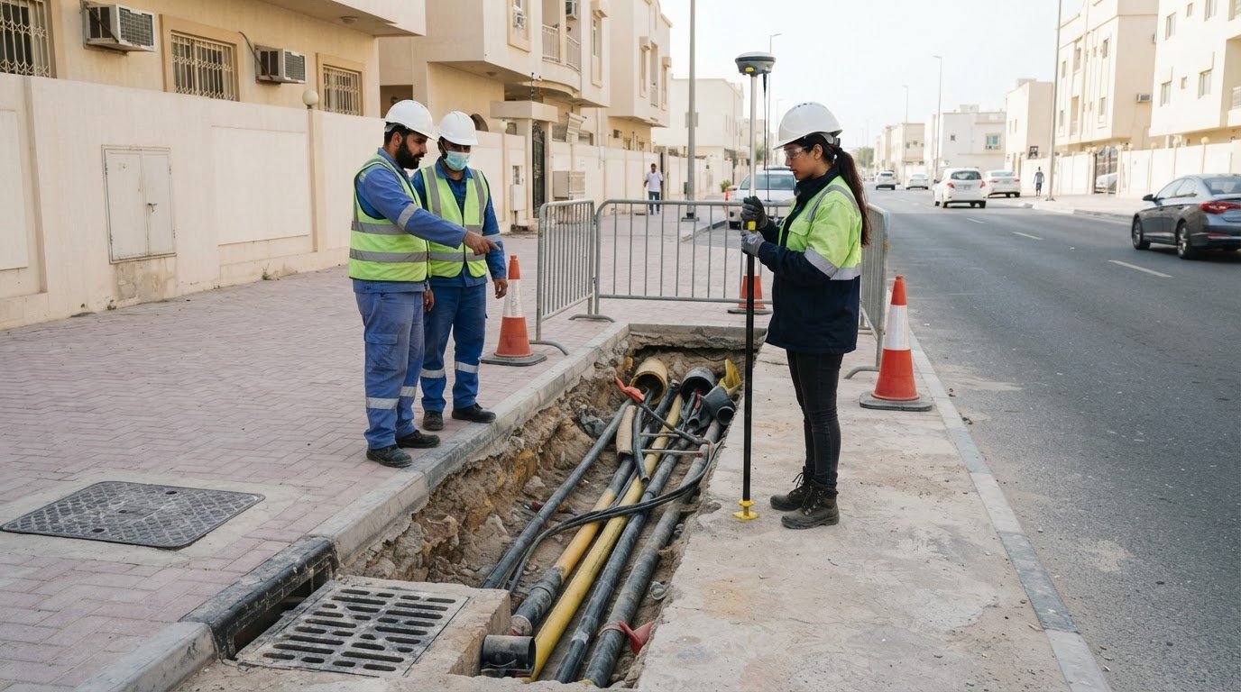
For underground asset context, utilities mapping and GPR services can support the collection and mapping of utility information.
GEOTECH 3D
GEOTECH 3D supports projects that need dependable spatial information as an input to connected GIS workflows. Its GIS & Surveying Services, topo surveys, 3D Laser Scanning and Drone Services can help teams capture and map site conditions for planning, asset records and geographic analysis.
For government teams in Dubai and across the UAE, the right data-capture approach depends on the area, features and intended use. Surveyed terrain, mapped infrastructure and captured site details provide useful geospatial context when agencies align datasets with their systems and workflows.
If your team is assessing spatial data needs for a public-service or infrastructure project, contact GEOTECH 3D to discuss the project requirements.
Turn connected data into practical public value
For teams planning GIS data integration for government services, the next step is to define a practical outcome and align the work around it. Clarify which decision the information should support, who will use it and how updates will be managed. A focused scope helps teams move from technical connections to useful, sustainable workflows.
GEOTECH 3D can discuss how geospatial data capture and mapping requirements relate to a project’s intended use. Clear objectives help establish a sound basis for planning the next stage of your work in Dubai or elsewhere in the UAE.
With a defined purpose and coordinated approach, your team can build a stronger foundation for location-aware public services.
Frequently Asked Questions
How does GIS integration improve permitting workflows?
GIS integration helps permit reviewers assess a proposal alongside relevant location-based constraints. A reviewer can connect a submitted parcel identifier to mapped boundaries, then compare the proposal with applicable zoning or infrastructure layers. This can reduce repeated data entry and help route exceptions to the appropriate reviewer. Clear records of the datasets used in a decision also make review discussions easier to follow.
What does GIS stand for in government?
GIS stands for Geographic Information System. In government, it describes the information systems and workflows used to manage location-linked records, such as service locations, parcels or public assets. GIS helps staff view records spatially and relate them to administrative information. Its value depends on how well the mapped information supports a specific public task, such as planning a service area.
What is the value of enterprise-level GIS software solutions for national government organizations?
Enterprise GIS software gives national organizations a coordinated way to manage shared geographic information across agencies. It can support common data catalogues, consistent access roles and reusable mapping services. For example, a national infrastructure team and regional offices can work from an agreed asset layer while maintaining distinct operational records. This structure helps reduce duplicated data management and clarify responsibility for updates.
What does GIS data integration mean for government agencies?
GIS data integration means linking geographic information with records held in other government systems so they can be used together. A service request, for example, can be associated with a location identifier and linked to the relevant service district. Agencies need agreed field meanings and matching identifiers for these connections to work. The result supports analysis that considers both the place and its related administrative records.
Which GIS data formats, standards, and interoperability protocols do government agencies use?
Agencies choose formats and exchange methods to suit their software, data purpose and sharing requirements. CAD files and spreadsheets may supply source information, while Cloud Optimized GeoTIFF and GeoParquet support cloud-oriented geospatial data use. APIs, including REST-based interfaces, can exchange records between systems. Coordinate references, field names and metadata need consistent treatment so datasets remain interpretable when transferred or combined.
What data governance, privacy, security, and access-control rules apply to government GIS data integration?
Applicable controls depend on the agency, the information involved and its intended use. Sound governance assigns data owners, defines permitted uses and separates public information from restricted records. Access roles should match users’ work, such as allowing an editor to update an operational layer while others view it. Agencies should align these controls with their internal policies and applicable UAE requirements.
How can governments assess the quality, accuracy, and currency of integrated GIS data?
Governments can assess integrated data by checking whether mapped features align with authoritative references and whether attributes match their source records. For a parcel layer, checks might compare boundary geometry, identifiers and required fields. Record dataset dates and version history so staff can distinguish current information from older extracts. A discrepancy log helps custodians prioritize corrections and document changes for later review.
What are the common risks and challenges in government GIS data integration, and how can they be mitigated?
Common challenges include inconsistent field meanings, coordinate misalignment, outdated extracts and dependencies on older applications. Agencies can limit disruption by testing a representative workflow before broader deployment, documenting transformations and keeping a controlled record of changes. A rollback plan helps teams restore the previous connection if testing reveals errors. Named system owners and clear escalation routes also help resolve issues promptly.
A permit, a utility record and a public service request can all describe the same place yet sit in separate systems. GIS data integration for government connects geospatial information with agency data and workflows, giving staff location context for planning, reviews and service delivery. In Abu Dhabi, the Spatial Data Infrastructure Program aims to facilitate geospatial data sharing, make high-quality data available and help government entities develop GeoSmart services.
Connecting systems is only part of the work. Information also needs consistent location references, useful metadata and a clear path into staff decisions. When these elements align, teams can bring maps, records and operational processes together instead of treating each dataset as an isolated resource.
This article explains how public agencies can integrate geospatial data with legacy systems, support collaboration across departments and make location information useful to staff and the public. It also covers practical applications, including permit review, infrastructure management and emergency response, in the UAE context.
Key Takeaways
- See how combining location data with agency workflows can support planning, permit review, infrastructure management and public services.
- Learn what helps CAD files, spreadsheets and legacy systems work together, from consistent location references to reliable data exchange.
- Understand how enterprise GIS can support collaboration across departments while clarifying how data is maintained and shared.
- Explore ways to make maps and location information more useful to staff, citizens, contractors and reviewers.
- Identify where GIS and surveying services can support better-quality geospatial data for connected public services in the UAE.
How to use geospatial data integration in public services?
For public services, geospatial integration links location data with agency records and workflows. In the UAE, shared geographic information can help departments coordinate planning, reviews, asset management and public-facing services.
Shared Geospatial Data Across Departments
Shared geospatial data is location-based information that departments can access and use through agreed systems and rules. Planning teams, for example, can view zoning boundaries alongside transport and environmental layers. Infrastructure teams can connect asset locations with maintenance records. A shared platform gives leaders a consistent geographic reference for decisions and helps prevent conflicting map versions across departments.
Abu Dhabi’s Spatial Data Infrastructure Program aims to facilitate geospatial data sharing, improve access to high-quality information and help government entities develop GeoSmart services. Shared access is useful when an application, public asset or service area crosses departmental responsibilities. Clear ownership, update schedules and access permissions help departments use common data while remaining accountable for their own records.
Geospatial Data Quality and Governance
Geospatial data governance defines who maintains a dataset, how it is described and how others can use it. Quality checks can assess geometry, metadata completeness and usage patterns. Before another department relies on a road layer, for example, it needs consistent coordinates, a named custodian and a recorded update date.
These checks matter because an inaccurate boundary can affect a permit review, while missing metadata can make a useful layer difficult to interpret. Government teams can improve quality through ongoing user feedback and scheduled review. The United Nations Sustainable Development Goals comprise 17 goals and include 169 targets, according to the United Nations. The United Nations global indicator framework includes 234 unique indicators, offering a structured example of how shared definitions support consistent reporting.
Government GIS Platforms and Integration Tools
Government GIS platforms manage, analyse and display geographic information; integration tools connect them with other systems. Enterprise GIS supports mapped data and analysis, while cloud platforms can provide shared access and scalable storage. APIs exchange records between applications, and transformation tools help align fields and formats. The UAE Environmental Geospatial Platform is one example, focused on environmental and agricultural spatial data.
Cloud Optimized GeoTIFF and GeoParquet are cloud-friendly formats that support flexible access and querying. The right combination depends on existing systems, data volume, access needs and staff workflows. Integration costs can include software licensing, migration, interfaces, cloud hosting, security and ongoing maintenance. These factors shape the total investment, so no single cost applies to every government program.
Integrating Data from Legacy Systems
Agencies can integrate GIS with legacy systems by identifying authoritative records, mapping fields and location references, then connecting systems through APIs or scheduled transfers. For example, a spreadsheet of service locations can be matched to a consistent geographic identifier before its records are displayed alongside mapped assets.
CRM, ERP and analytics systems can use location information to add geographic context to non-spatial records. When direct interfaces are unavailable, controlled exports and imports can maintain a dependable update cycle. Teams should document transformations and errors, then assign responsibility for resolving mismatches. This lets departments retain established workflows while making location data more useful.
Connected data can support specific public-service tasks. Permit reviewers can compare an application with zoning, environmental constraints and infrastructure information. Emergency teams can combine incident reports, traffic conditions and resource locations for situational awareness. Urban planners can use zoning maps, demographic information and environmental monitoring to assess development options. Each use depends on current, interpretable data that is accessible to decision-makers.
Connecting CAD files, spreadsheets, and legacy systems
A government geographic information system is more useful when it connects spatial records with everyday agency workflows. Integration planning starts by identifying which records need to move between systems and how staff will use them.
Interoperability with Enterprise Systems
Interoperability lets GIS exchange location-linked records with CRM, ERP and analytics systems. Departments gain geographic context for information they already manage, such as linking a service request to an asset or parcel.
For example, a maintenance record in an ERP can be linked to an asset location, while CRM requests can be grouped by service area. Integration can replace repeated exports with record updates through APIs. Reported government examples show asset-data accuracy rising from about 74% to more than 98% with API integration. Results depend on data definitions and implementation quality.
Evaluating Workflows and System Integration
Workflow evaluation reveals where staff re-enter, transfer or reconcile information across applications. A permit review, for instance, may involve CAD drawings, spreadsheet registers and a case-management system. Mapping each handoff shows where location identifiers differ, records become outdated or teams need to resolve discrepancies.
Agencies can then prioritize interfaces around high-value tasks instead of connecting every system at once. Reported API integration examples show manual cross-system transfer work reduced by 70-85% in government environments. A useful assessment also considers reviewer time spent switching systems, data ownership and update frequency.
Planning GIS Integration Projects
Planning and implementation begin with a system inventory, workflow review and defined data requirements. Teams then map fields and geographic identifiers, select an exchange method, test representative records, and deploy and monitor the connection. The key is to align systems around a clear use case before expanding the integration.
For a national or local dataset, document which system is authoritative for each field. Bayanat, the UAE national data portal, publishes geospatial and GIS datasets. Agencies can use relevant datasets as inputs while retaining clear ownership of operational records and documenting any transformations.
CAD files need particular attention because drawing layers, coordinate references and asset labels can differ between projects. A road alignment in a CAD file, for example, can be aligned with GIS features before its attributes are linked to a spreadsheet or ERP record. Preserve the source file, record conversion rules and review sample features for shifted geometry or missing attributes.
For property records, linking spatial boundaries with structured ownership information provides a related application. Explore real estate strata services as a way to understand how property information can be organized spatially.
Enterprise GIS and interagency collaboration
Enterprise GIS gives departments a shared environment for managing and using geographic information across government. In the UAE, Abu Dhabi’s Spatial Data Infrastructure Program aims to strengthen the development, engagement and organisation of its SDI community. This matters when infrastructure, environmental and service data crosses agency boundaries and requires coordinated access and clear responsibilities.
Interagency collaboration works best when departments agree how shared layers are described, maintained and accessed. Transport teams, for example, can contribute road information for planning teams to use alongside land-use data. Each department remains responsible for its source records, while shared definitions help other teams interpret them consistently. A common platform can make layers available for analysis without requiring agencies to replace their existing systems.
Abu Dhabi’s program also aims to catalyse progress towards the next generation of spatial data infrastructure, SDI 3.0. That direction highlights the value of treating GIS as connected government infrastructure, rather than a collection of isolated maps. Leaders can support that shift by identifying priority datasets, assigning custodians and setting practical rules for updates, access and reuse. These decisions help teams build a dependable basis for shared geographic intelligence.
Consider a public works project involving road corridors, drainage assets and environmental constraints. Different departments may hold each dataset, but a coordinated GIS environment can bring them into one analytical view. Staff can identify overlaps, see which agency owns each record and route follow-up to the responsible team. The map does not replace technical review; it helps participants work from a common spatial context.
Successful collaboration also depends on matching access to each user’s role. A department maintaining an asset may need to edit its records, while another agency may only need to view them. Documented permissions, metadata and update procedures help protect data integrity as participation grows. This governance gives leaders a clearer path to improving shared services without uncertainty about who owns or changes a dataset.
Coordination can start with one cross-agency use case, such as planning around shared infrastructure. Participating departments identify the required layers, agree on the meaning of key fields and document update responsibilities. They then test whether users can find and interpret the information on the shared platform. Lessons from that use case can guide wider integration, keeping expansion aligned with operational needs and agency capacity.
For UAE government teams, the central task is to connect institutional responsibilities with useful spatial information. Abu Dhabi’s SDI community provides a local context for this work, while each department contributes its knowledge of particular datasets and workflows. Clear custodianship, agreed terminology and purposeful access turn interagency GIS into a practical coordination mechanism for more informed public-service decisions.
GIS visibility for staff, citizens, contractors, and reviewers
GIS visibility means presenting relevant geospatial data through maps and tools suited to each user’s role. For UAE agencies, clear views help staff coordinate decisions and give citizens, contractors and reviewers information they can interpret.
Staff need operational views that bring related datasets together. A maintenance team, for example, can see an asset’s mapped location alongside its condition record and service history. A planning team may need zoning and environmental layers for the same area. Role-based views keep each workflow focused, while shared geographic references help departments discuss the same place accurately.
Plan reviewers benefit when GIS software brings infrastructure layers, imagery and application details into one review environment. They can overlay proposed plans on aerial imagery, measure distances to property lines and view underground utilities. Historic district boundaries, zoning layers, flood zones and environmental restrictions can also inform geographic code reviews. Showing these alongside traditional two-dimensional plans helps reviewers identify potential conflicts before construction.
Contractors need location information that supports coordination in the field and across project teams. A shared map can show relevant infrastructure and utility records beside work areas, helping users understand the site context. Clear dataset dates, feature descriptions and source ownership help distinguish a mapped reference from a current field condition. These details make the map more useful without replacing technical review.
Citizen-facing maps can make service information easier to understand. A public portal might let residents locate a service area, view relevant facilities or submit a location-based request. A mapped report of a damaged streetlight, for example, gives an agency a clearer location than a text description alone. Portal design should make reporting straightforward and limit public views to information intended for public access.
Visibility depends on how systems present information, not simply on how much data they contain. Agencies can start by identifying the decision each audience needs to make, selecting relevant datasets and arranging them in a clear map view. They can then test the workflow with representative users, such as permit reviewers, field staff and residents. Feedback can reveal confusing symbols, missing context or unnecessary layers.
The UAE Environmental Geospatial Platform, provided by the Ministry of Climate Change and Environment, is an example of an interface for environmental and agricultural spatial data. Such platforms can provide focused access to relevant datasets. For integrated plan review, teams can bring imagery, utility locations, parcel details and zoning information into a coordinated view, helping reviewers assess applications with consistent geographic context.
Government data integration
Government data integration connects spatial datasets with administrative records so agencies can analyse related information together. In the UAE, the Ministry of Interior Geospatial Data includes coordinates for service centres across the country. Combining these locations with service records can help teams map coverage and understand where residents may need access. Effective GIS data integration for government starts with a clear operational question and the datasets needed to answer it.
For a service-access analysis, teams can identify the location field that links each service centre to its administrative record. Document the source, date and meaning of each field before combining records. This matters when datasets use different names for the same location or administrative area. Consistent identifiers help analysts match records accurately, while documented definitions make the results easier for other teams to interpret.
Bayanat, the UAE national data portal, publishes geospatial and Geographic Information System datasets. Agencies can consider relevant published information alongside operational records, noting each dataset’s source and intended use. A clear catalogue helps staff determine whether a layer suits an analysis and which department maintains its underlying information. It also provides context when datasets have different update cycles or attribute structures.
The UAE National Registry of Non-Profit Organizations is a centralized database intended to support government data integration. Linking organizational records with geographic areas can help teams map service locations and examine coverage patterns. The link between a record and its location should remain clear, with updates assigned to the appropriate data owner. This supports analysis without obscuring the origin of the information.
Public health agencies can combine disease surveillance, environmental factors and demographic data to support early outbreak detection and targeted interventions. Spatial analysis can reveal patterns that separate tables may conceal, such as cases clustering near a particular environmental condition. Teams should agree on field definitions and access arrangements before combining information so analysts interpret attributes consistently.
To keep mapped information current, agencies can compare updated imagery or survey information with existing geospatial records, flag changes and send them to the appropriate custodian. A changed road alignment, for example, may prompt a review of connected asset or service-area records. Documenting the change, its source and the review outcome gives staff a traceable basis for updating affected datasets.
Governance also determines which information different users can access. A service-centre location may be suitable for public mapping, while linked administrative details may require restricted access. Government teams can define permissions by role and purpose, then record data owners and correction procedures. These controls support coordination while ensuring access matches users’ responsibilities.
For underground asset context, utilities mapping and GPR services can support the collection and mapping of utility information.
GEOTECH 3D
GEOTECH 3D supports projects that need dependable spatial information as an input to connected GIS workflows. Its GIS & Surveying Services, topo surveys, 3D Laser Scanning and Drone Services can help teams capture and map site conditions for planning, asset records and geographic analysis.
For government teams in Dubai and across the UAE, the right data-capture approach depends on the area, features and intended use. Surveyed terrain, mapped infrastructure and captured site details provide useful geospatial context when agencies align datasets with their systems and workflows.
If your team is assessing spatial data needs for a public-service or infrastructure project, contact GEOTECH 3D to discuss the project requirements.
Turn connected data into practical public value
For teams planning GIS data integration for government services, the next step is to define a practical outcome and align the work around it. Clarify which decision the information should support, who will use it and how updates will be managed. A focused scope helps teams move from technical connections to useful, sustainable workflows.
GEOTECH 3D can discuss how geospatial data capture and mapping requirements relate to a project’s intended use. Clear objectives help establish a sound basis for planning the next stage of your work in Dubai or elsewhere in the UAE.
With a defined purpose and coordinated approach, your team can build a stronger foundation for location-aware public services.
Frequently Asked Questions
How does GIS integration improve permitting workflows?
GIS integration helps permit reviewers assess a proposal alongside relevant location-based constraints. A reviewer can connect a submitted parcel identifier to mapped boundaries, then compare the proposal with applicable zoning or infrastructure layers. This can reduce repeated data entry and help route exceptions to the appropriate reviewer. Clear records of the datasets used in a decision also make review discussions easier to follow.
What does GIS stand for in government?
GIS stands for Geographic Information System. In government, it describes the information systems and workflows used to manage location-linked records, such as service locations, parcels or public assets. GIS helps staff view records spatially and relate them to administrative information. Its value depends on how well the mapped information supports a specific public task, such as planning a service area.
What is the value of enterprise-level GIS software solutions for national government organizations?
Enterprise GIS software gives national organizations a coordinated way to manage shared geographic information across agencies. It can support common data catalogues, consistent access roles and reusable mapping services. For example, a national infrastructure team and regional offices can work from an agreed asset layer while maintaining distinct operational records. This structure helps reduce duplicated data management and clarify responsibility for updates.
What does GIS data integration mean for government agencies?
GIS data integration means linking geographic information with records held in other government systems so they can be used together. A service request, for example, can be associated with a location identifier and linked to the relevant service district. Agencies need agreed field meanings and matching identifiers for these connections to work. The result supports analysis that considers both the place and its related administrative records.
Which GIS data formats, standards, and interoperability protocols do government agencies use?
Agencies choose formats and exchange methods to suit their software, data purpose and sharing requirements. CAD files and spreadsheets may supply source information, while Cloud Optimized GeoTIFF and GeoParquet support cloud-oriented geospatial data use. APIs, including REST-based interfaces, can exchange records between systems. Coordinate references, field names and metadata need consistent treatment so datasets remain interpretable when transferred or combined.
What data governance, privacy, security, and access-control rules apply to government GIS data integration?
Applicable controls depend on the agency, the information involved and its intended use. Sound governance assigns data owners, defines permitted uses and separates public information from restricted records. Access roles should match users’ work, such as allowing an editor to update an operational layer while others view it. Agencies should align these controls with their internal policies and applicable UAE requirements.
How can governments assess the quality, accuracy, and currency of integrated GIS data?
Governments can assess integrated data by checking whether mapped features align with authoritative references and whether attributes match their source records. For a parcel layer, checks might compare boundary geometry, identifiers and required fields. Record dataset dates and version history so staff can distinguish current information from older extracts. A discrepancy log helps custodians prioritize corrections and document changes for later review.
What are the common risks and challenges in government GIS data integration, and how can they be mitigated?
Common challenges include inconsistent field meanings, coordinate misalignment, outdated extracts and dependencies on older applications. Agencies can limit disruption by testing a representative workflow before broader deployment, documenting transformations and keeping a controlled record of changes. A rollback plan helps teams restore the previous connection if testing reveals errors. Named system owners and clear escalation routes also help resolve issues promptly.
Search Now
Error: Contact form not found.