

Our Services
Mobile LiDAR Mapping in the Middle East: From Field Capture to Usable Data
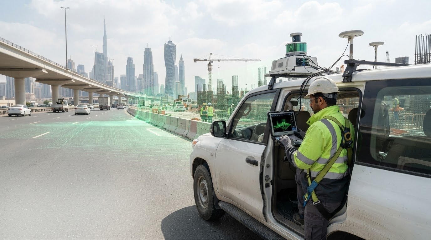
For mobile LiDAR mapping Middle East projects, the right capture method depends on what the project needs to decide, not simply on the scanner. In Dubai and across the UAE, start by defining the site, access conditions, safety requirements, and intended use of the data. Mobile capture can suit connected routes and environments, but it is not the right fit for every survey task.
Before planning fieldwork, establish what the survey must cover, which features matter, and what the project team needs to receive. This guide explains where vehicle-mounted and wearable systems can fit, how they compare with static terrestrial scanning and drone surveying, and what to consider when planning a safe, well-scoped capture workflow.
Captured point clouds can inform spatial data for engineering, asset management, GIS, or BIM workflows, depending on the project scope and agreed deliverables. GEOTECH 3D provides mobile LiDAR, surveying, and mapping services in Dubai and the UAE, with the capture approach shaped around the decisions the data needs to support.
Key Takeaways
- Define the decisions and deliverables first, then assess whether mobile LiDAR suits the site and task.
- Plan around coverage, access, operating conditions, safety, and the level of detail the project requires.
- Compare mobile, drone, and static scanning by site type and viewpoint rather than assuming one method fits every project.
- For mobile LiDAR mapping Middle East projects, specify how georeferenced data will support engineering, mapping, or asset-management work.
- Set capture boundaries and coordinate any related GIS or surveying requirements so the resulting data is useful to the project team.
What Mobile LiDAR Mapping Means for Middle East Projects
Mobile LiDAR mapping collects spatial measurements from a moving platform to create a mapped representation of an environment. The platform travels along a road or through a site while recording surrounding surfaces and features. This can help document connected areas without relying only on measurements taken at isolated points. The broader principles of Mobile mapping show how positioning, sensing, and data processing work together to represent places in spatial context.
For a mobile LiDAR mapping Middle East project, value comes from how the resulting data supports a defined task. Georeferenced measurements can be related to locations and used for mapping, existing-condition documentation, and project decisions. The capture method is not the deliverable. Set the required formats, coverage, and level of detail according to how the team will use the data.
How mobile LiDAR capture differs from static scanning and aerial mapping
Mobile capture records measurements as the sensor platform moves, which can suit routes and connected spaces. Static 3D laser scanning captures the environment from fixed positions and can suit focused documentation where planned scan locations provide the views required. Aerial mapping offers a view from above and can support broad site or topographic requirements. It does not automatically replace ground-level capture when the features or access conditions call for another viewpoint.
Where mobile LiDAR can support Dubai and UAE projects
Potential applications include mapping road corridors, documenting site conditions, and recording visible assets across an area. Developers and contractors can use spatial records to understand existing conditions. Consultants may use them as reference information for design or coordination, while asset owners may use mapped records in planning and management. The right application depends on the scope and site conditions.
A long, connected route presents a different capture challenge from a compact facility, an active site, or an area with restricted access. Define the boundary, the features that matter, the required detail, and the decisions the data will inform. Safety and coordination also affect field planning, particularly near traffic, active construction, or ongoing operations.
In Dubai and across the UAE, these considerations help align the method with the survey’s purpose. Mobile LiDAR can be considered alongside Topographic Mapping, GIS and surveying, or other capture approaches when the project has related requirements. Defining the intended use early clarifies what needs to be captured and what spatial information the team expects to receive.
How a Mobile LiDAR Mapping Project Moves from Capture to Data
A reliable workflow starts with what the project needs to know, not simply where a sensor can travel. For mobile LiDAR mapping Middle East projects, the capture boundary, features of interest, access conditions, and intended use all shape the scope. A road inventory may require consistent coverage along a corridor, while a site documentation task may focus on selected areas and visible assets.
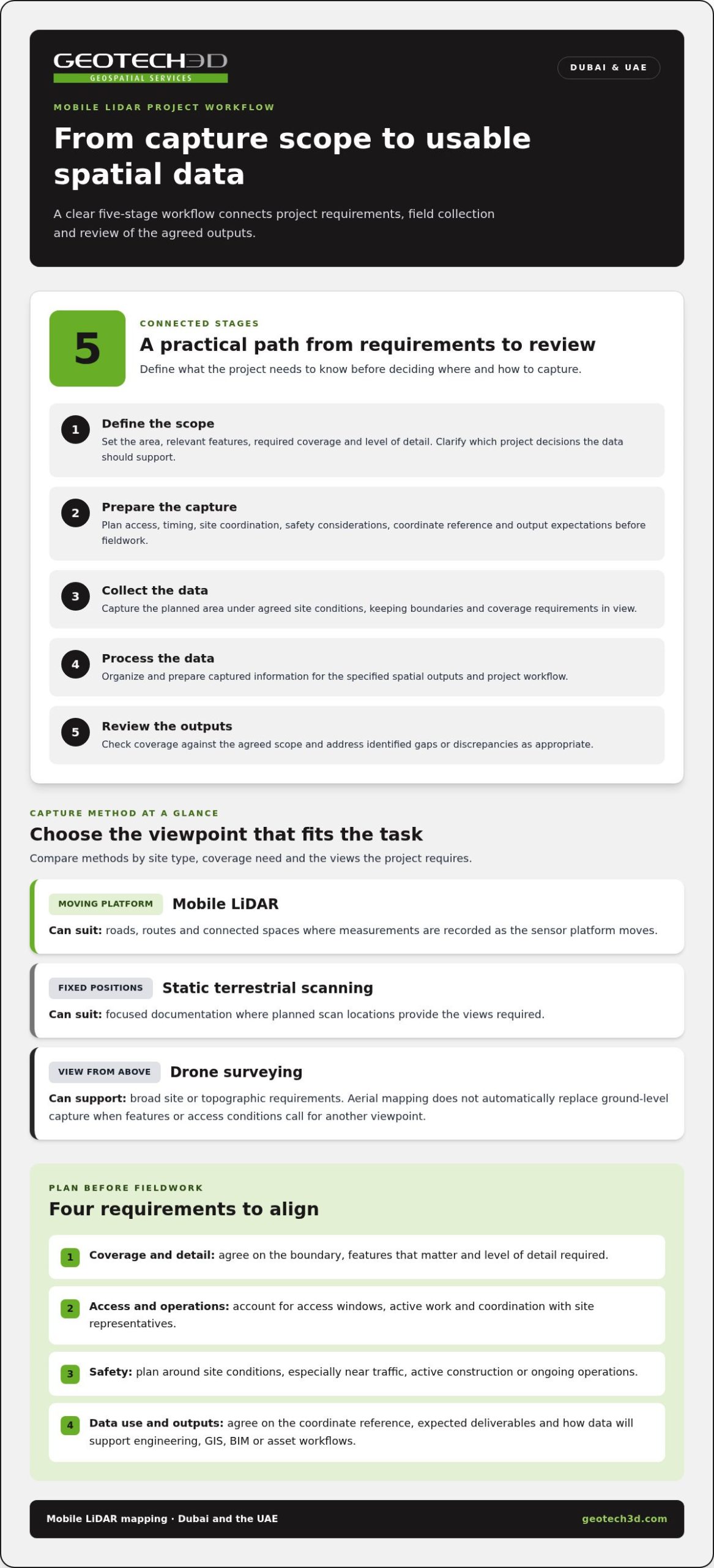
A mobile LiDAR project moves from a defined scope and planned capture through field collection and data processing to a review of outputs against agreed requirements.
- Define the scope. Set the area to be mapped, identify relevant features, and clarify which decisions the data should support. Establish the required coverage and level of detail.
- Prepare the capture. Plan access, timing, site coordination, safety considerations, coordinate references, and output expectations before fieldwork.
- Collect the data. Capture the planned area under the agreed site conditions, keeping the defined boundaries and coverage requirements in view.
- Process the data. Organize and prepare the captured information for the specified spatial outputs and project workflow.
- Review the outputs. Check coverage against the agreed scope and address identified gaps or discrepancies as appropriate.
Planning capture around site access and project requirements
Identify the site limits, the features that matter, and the decisions the mapping will inform. Then account for access windows, active operations, safety requirements, and coordination with the people responsible for the site. Agree on the coordinate reference and expected outputs before capture so field teams and data users work to the same requirements.
Plan coverage and detail together. Capturing a wider area than necessary can add data without serving the project’s purpose; limiting coverage too narrowly can leave important connections undocumented. For an active site, agreed boundaries and access arrangements help coordinate field activity with ongoing work and avoid unnecessary disruption.
Turning captured data into usable mapping outputs
After field capture, process and organize the data according to the agreed deliverables. Review whether the required area and relevant features are represented, and whether the outputs align with the project’s coordinate reference and scope. This check assesses completeness against the requirements; it does not replace defining those requirements before capture.
Clear deliverable expectations help the receiving team use the data. Depending on the project, outputs may support GIS analysis, CAD documentation, or other engineering and asset workflows. GEOTECH 3D’s mobile LiDAR mapping services support project-specific capture and spatial data requirements in Dubai and the UAE.
Mobile LiDAR, Drone Surveying, and Static Scanning: Choosing the Right Fit
Each capture method answers different spatial questions. Mobile LiDAR records an environment from a moving platform, drone surveying provides an aerial viewpoint, and static 3D laser scanning measures from fixed positions. For mobile LiDAR mapping Middle East projects, choose by site conditions, access, required detail, and intended data use. No method suits every mapping objective.
| Consideration | Mobile LiDAR | Drone surveying | Static 3D laser scanning |
|---|---|---|---|
| Site type | Potential fit for corridors and connected environments | Potential fit for broad areas where aerial coverage suits the scope | Potential fit for selected structures, rooms, or fixed features |
| Viewpoint | Ground-level capture along a moving route | View from above | Views from planned stationary positions |
| Access | Depends on safe access along the capture path | Depends on site conditions and the feasibility of aerial operations | Requires access to suitable positions around the area of interest |
| Intended use | Route, site, or visible-asset documentation | Broad-area or topographic mapping needs | Detailed documentation of selected spaces or structures |
| Output requirements | Set according to required coverage and downstream use | Set according to aerial mapping objectives | Set according to the detail needed for the fixed area |
When mobile LiDAR may suit corridors and connected environments
A continuous road route, access network, or connected site may suit mobile capture if the planned path provides a useful view of the features in scope. The sensor can record only what is visible from its capture positions. Parked vehicles, structures, vegetation, restricted areas, and other obstructions may block views. Spaces away from the route may need separate planning. Coverage, accuracy, and field duration depend on project conditions, so assess them against the defined requirements rather than assuming them from the method alone.
When aerial or stationary capture may be more appropriate
Aerial mapping can provide a useful overview for broad-area work when the project requires an above-ground perspective. Static scanning may be more appropriate for detailed documentation of a fixed structure or interior, where planned scan positions can capture the required views. GEOTECH 3D’s 3D laser scanning renovation guide explores how stationary scanning can support renovation documentation.
Some projects benefit from complementary viewpoints. Aerial capture may address broad site context, while mobile or static capture focuses on ground-level features or selected structures. Combining methods adds coordination and processing requirements, so define the intended outputs first. Compare each approach by access, visibility, level of detail, and how the data will support design, construction, mapping, or asset-management decisions. This keeps the capture plan tied to the project instead of treating one technology as a universal solution.
Planning Mobile LiDAR Mapping for a UAE Site
Good field planning turns a capture method into a workable site activity. For mobile LiDAR mapping Middle East projects, define the area and intended use before scheduling capture. In Dubai and across the UAE, sites may include active construction, operating facilities, roads, or controlled-access areas. Clear boundaries and coordination with site teams help align fieldwork with day-to-day operations.
Information to define before fieldwork
Bring the project team, site contacts, and data users into the planning process. Clarify the survey limits, the features that matter, and the coordinate reference. Identify who will use the data and which formats and level of detail will support their work.
- Area and boundaries: Define the capture limits, entry points, and any excluded or restricted zones.
- Features and intended use: Specify which visible assets or surfaces matter and whether the data will inform design coordination, documentation, mapping, or asset management.
- Access and operations: Identify active work areas, access conditions, operating schedules, and site coordination needed to avoid conflicts.
- Safety: Record relevant site safety requirements and agree how field activity will be coordinated with the responsible site team.
- Spatial and delivery requirements: Agree on the coordinate reference, output formats, and expected level of detail with the people who will use the data.
These decisions clarify what must be captured and where. A defined boundary helps field teams avoid unnecessary access, while identifying active operations in advance lets them plan around site activity. If the mapped area or intended use changes, review the scope and deliverables so the final data remains relevant.
Handling surface mapping and underground utility needs
LiDAR records visible surfaces from the sensor’s viewpoint. It does not, by itself, locate buried pipes, cables, or other underground utilities. This distinction matters before excavation, design coordination, or work near existing services. A surface map may document visible features, but it cannot establish what lies below ground.
For subsurface requirements, Utility Mapping (GPR) is distinct from mobile LiDAR capture. Where a project needs both surface and subsurface information, plan them as complementary tasks and define each scope for its intended use. The Dubai subsurface utility engineering guide provides additional context for projects that need underground utility information.
Before fieldwork, bring together the capture area, access conditions, safety considerations, output needs, and any subsurface questions. GEOTECH 3D provides mobile LiDAR mapping and Utility Mapping (GPR) for project requirements in Dubai and the UAE.
GEOTECH 3D Mobile LiDAR Mapping in Dubai and the UAE
GEOTECH 3D provides mobile LiDAR mapping as part of its geospatial services in Dubai and across the UAE. The work starts by defining what the project needs to document and how the spatial data will be used. A corridor mapping requirement differs from a site documentation brief or an asset-management need. Aligning the capture scope with the intended decisions keeps the work focused on relevant information.
For mobile LiDAR mapping Middle East projects, let site conditions and deliverables guide the approach. GEOTECH 3D’s GIS and surveying capabilities can support coordination around how captured information fits wider project needs. The scope should reflect the project objectives, site conditions, and data requirements rather than including methods the project does not need.
Connecting mobile LiDAR with wider surveying requirements
Some projects need terrain and surface information in addition to mobile capture. Topographic Mapping may be relevant where those details form part of the scope. GIS and surveying coordination can help teams plan how spatial data will be used across design, construction, and asset management. If the next requirement is a building information model, Scan to BIM is a separate downstream modeling task, not an automatic outcome of LiDAR capture.
These distinctions matter when setting the scope. A team that needs mapped surface features, terrain context, and a model for building coordination should identify each requirement separately. This clarifies which capture and processing tasks belong in the project and the outputs expected for each use.
What to bring to an initial project discussion
A focused discussion starts with a clear description of the site and intended outcomes. Share available location information, define the boundaries, and note access conditions or restricted areas. Identify the features to be mapped, the coordinate reference, and preferred output formats. These details help shape a practical scope instead of relying on a general request for scanning.
- Location plan and boundaries: Mark the project area, routes, and any areas to exclude.
- Access information: Describe site conditions, operating activities, and relevant safety coordination.
- Required features: Identify the surfaces or visible assets that matter to the project.
- Spatial and data needs: Specify coordinate references, preferred formats, and the intended use of the outputs.
- Project stakeholders: Include relevant engineering, surveying, construction, and asset-management representatives in scope alignment.
Involving the people who will use the data helps surface different requirements early. Engineers may need spatial information for coordination, while asset teams may focus on records for ongoing management. GEOTECH 3D can discuss project objectives, site conditions, required data, and intended use to develop a scope aligned with the work.
Turn Your Mapping Objectives into a Clear Next Step
Useful spatial data can support decisions beyond a single survey milestone. Treating it as a shared reference for people responsible for design, construction, and asset management can help maintain continuity as a project moves forward. The clearer the data’s role within the team, the easier it is to put it to work.
Once the intended use is clear, your team can move from comparing capture methods to planning how spatial information will contribute to project decisions.
Share your project location, capture boundaries, intended use, and required outputs with GEOTECH 3D to discuss mobile LiDAR mapping in Dubai and the UAE.
Frequently Asked Questions
Is mobile LiDAR mapping suitable for construction projects in the UAE?
It can suit construction work when a moving capture approach can document the information the team needs. For example, a project may need a spatial record of accessible road edges or external site features for coordination. Suitability depends on the site and task. Define the decisions the information must support, then assess whether the planned capture can provide relevant data within the site’s operating and safety constraints.
Can mobile LiDAR mapping locate underground utilities?
No. Mobile LiDAR alone cannot establish the position of buried pipes or cables. A surface dataset used during early design should not be treated as a record of underground services or used alone to plan excavation. GEOTECH 3D provides Utility Mapping (GPR) as a separate service for subsurface mapping. Treat surface and underground information as distinct records, each interpreted for its intended purpose.
How accurate is mobile LiDAR mapping?
Accuracy is not a single fixed value for every project. Define the required accuracy in terms that match the intended decisions and agree how the results will be assessed. A dataset used for general spatial reference may have different acceptance criteria from one supporting detailed design coordination. Set the capture and review plan against those criteria rather than assuming a universal specification.
Does mobile LiDAR mapping work indoors as well as outdoors?
It may be considered in either setting, but indoor and outdoor areas can have different capture constraints. A facility with open circulation areas, enclosed rooms, and exterior access routes may need each space described separately so the scope reflects its conditions. Identify the intended use of each area and note locations that need particular attention when planning the capture approach.
How long does a mobile LiDAR mapping project take?
There is no standard duration for every project. Plan around the full sequence of work, including site readiness, data handover, and review, rather than field capture alone. Access coordination and changes to the requested scope can affect the programme. A project schedule should account for these dependencies and the agreed review requirements.
How much does mobile LiDAR mapping cost in Dubai?
Project costs depend on the scope, so a generic figure would not represent the work required in Dubai. Set out the area, information needed, intended deliverables, and any coordination with other survey tasks. These details help define the work involved and keep the project scope tied to its actual requirements.
For mobile LiDAR mapping Middle East projects, the right capture method depends on what the project needs to decide, not simply on the scanner. In Dubai and across the UAE, start by defining the site, access conditions, safety requirements, and intended use of the data. Mobile capture can suit connected routes and environments, but it is not the right fit for every survey task.
Before planning fieldwork, establish what the survey must cover, which features matter, and what the project team needs to receive. This guide explains where vehicle-mounted and wearable systems can fit, how they compare with static terrestrial scanning and drone surveying, and what to consider when planning a safe, well-scoped capture workflow.
Captured point clouds can inform spatial data for engineering, asset management, GIS, or BIM workflows, depending on the project scope and agreed deliverables. GEOTECH 3D provides mobile LiDAR, surveying, and mapping services in Dubai and the UAE, with the capture approach shaped around the decisions the data needs to support.
Key Takeaways
- Define the decisions and deliverables first, then assess whether mobile LiDAR suits the site and task.
- Plan around coverage, access, operating conditions, safety, and the level of detail the project requires.
- Compare mobile, drone, and static scanning by site type and viewpoint rather than assuming one method fits every project.
- For mobile LiDAR mapping Middle East projects, specify how georeferenced data will support engineering, mapping, or asset-management work.
- Set capture boundaries and coordinate any related GIS or surveying requirements so the resulting data is useful to the project team.
What Mobile LiDAR Mapping Means for Middle East Projects
Mobile LiDAR mapping collects spatial measurements from a moving platform to create a mapped representation of an environment. The platform travels along a road or through a site while recording surrounding surfaces and features. This can help document connected areas without relying only on measurements taken at isolated points. The broader principles of Mobile mapping show how positioning, sensing, and data processing work together to represent places in spatial context.
For a mobile LiDAR mapping Middle East project, value comes from how the resulting data supports a defined task. Georeferenced measurements can be related to locations and used for mapping, existing-condition documentation, and project decisions. The capture method is not the deliverable. Set the required formats, coverage, and level of detail according to how the team will use the data.
How mobile LiDAR capture differs from static scanning and aerial mapping
Mobile capture records measurements as the sensor platform moves, which can suit routes and connected spaces. Static 3D laser scanning captures the environment from fixed positions and can suit focused documentation where planned scan locations provide the views required. Aerial mapping offers a view from above and can support broad site or topographic requirements. It does not automatically replace ground-level capture when the features or access conditions call for another viewpoint.
Where mobile LiDAR can support Dubai and UAE projects
Potential applications include mapping road corridors, documenting site conditions, and recording visible assets across an area. Developers and contractors can use spatial records to understand existing conditions. Consultants may use them as reference information for design or coordination, while asset owners may use mapped records in planning and management. The right application depends on the scope and site conditions.
A long, connected route presents a different capture challenge from a compact facility, an active site, or an area with restricted access. Define the boundary, the features that matter, the required detail, and the decisions the data will inform. Safety and coordination also affect field planning, particularly near traffic, active construction, or ongoing operations.
In Dubai and across the UAE, these considerations help align the method with the survey’s purpose. Mobile LiDAR can be considered alongside Topographic Mapping, GIS and surveying, or other capture approaches when the project has related requirements. Defining the intended use early clarifies what needs to be captured and what spatial information the team expects to receive.
How a Mobile LiDAR Mapping Project Moves from Capture to Data
A reliable workflow starts with what the project needs to know, not simply where a sensor can travel. For mobile LiDAR mapping Middle East projects, the capture boundary, features of interest, access conditions, and intended use all shape the scope. A road inventory may require consistent coverage along a corridor, while a site documentation task may focus on selected areas and visible assets.
A mobile LiDAR project moves from a defined scope and planned capture through field collection and data processing to a review of outputs against agreed requirements.
- Define the scope. Set the area to be mapped, identify relevant features, and clarify which decisions the data should support. Establish the required coverage and level of detail.
- Prepare the capture. Plan access, timing, site coordination, safety considerations, coordinate references, and output expectations before fieldwork.
- Collect the data. Capture the planned area under the agreed site conditions, keeping the defined boundaries and coverage requirements in view.
- Process the data. Organize and prepare the captured information for the specified spatial outputs and project workflow.
- Review the outputs. Check coverage against the agreed scope and address identified gaps or discrepancies as appropriate.
Planning capture around site access and project requirements
Identify the site limits, the features that matter, and the decisions the mapping will inform. Then account for access windows, active operations, safety requirements, and coordination with the people responsible for the site. Agree on the coordinate reference and expected outputs before capture so field teams and data users work to the same requirements.
Plan coverage and detail together. Capturing a wider area than necessary can add data without serving the project’s purpose; limiting coverage too narrowly can leave important connections undocumented. For an active site, agreed boundaries and access arrangements help coordinate field activity with ongoing work and avoid unnecessary disruption.
Turning captured data into usable mapping outputs
After field capture, process and organize the data according to the agreed deliverables. Review whether the required area and relevant features are represented, and whether the outputs align with the project’s coordinate reference and scope. This check assesses completeness against the requirements; it does not replace defining those requirements before capture.
Clear deliverable expectations help the receiving team use the data. Depending on the project, outputs may support GIS analysis, CAD documentation, or other engineering and asset workflows. GEOTECH 3D’s mobile LiDAR mapping services support project-specific capture and spatial data requirements in Dubai and the UAE.
Mobile LiDAR, Drone Surveying, and Static Scanning: Choosing the Right Fit
Each capture method answers different spatial questions. Mobile LiDAR records an environment from a moving platform, drone surveying provides an aerial viewpoint, and static 3D laser scanning measures from fixed positions. For mobile LiDAR mapping Middle East projects, choose by site conditions, access, required detail, and intended data use. No method suits every mapping objective.
| Consideration | Mobile LiDAR | Drone surveying | Static 3D laser scanning |
|---|---|---|---|
| Site type | Potential fit for corridors and connected environments | Potential fit for broad areas where aerial coverage suits the scope | Potential fit for selected structures, rooms, or fixed features |
| Viewpoint | Ground-level capture along a moving route | View from above | Views from planned stationary positions |
| Access | Depends on safe access along the capture path | Depends on site conditions and the feasibility of aerial operations | Requires access to suitable positions around the area of interest |
| Intended use | Route, site, or visible-asset documentation | Broad-area or topographic mapping needs | Detailed documentation of selected spaces or structures |
| Output requirements | Set according to required coverage and downstream use | Set according to aerial mapping objectives | Set according to the detail needed for the fixed area |
When mobile LiDAR may suit corridors and connected environments
A continuous road route, access network, or connected site may suit mobile capture if the planned path provides a useful view of the features in scope. The sensor can record only what is visible from its capture positions. Parked vehicles, structures, vegetation, restricted areas, and other obstructions may block views. Spaces away from the route may need separate planning. Coverage, accuracy, and field duration depend on project conditions, so assess them against the defined requirements rather than assuming them from the method alone.
When aerial or stationary capture may be more appropriate
Aerial mapping can provide a useful overview for broad-area work when the project requires an above-ground perspective. Static scanning may be more appropriate for detailed documentation of a fixed structure or interior, where planned scan positions can capture the required views. GEOTECH 3D’s 3D laser scanning renovation guide explores how stationary scanning can support renovation documentation.
Some projects benefit from complementary viewpoints. Aerial capture may address broad site context, while mobile or static capture focuses on ground-level features or selected structures. Combining methods adds coordination and processing requirements, so define the intended outputs first. Compare each approach by access, visibility, level of detail, and how the data will support design, construction, mapping, or asset-management decisions. This keeps the capture plan tied to the project instead of treating one technology as a universal solution.
Planning Mobile LiDAR Mapping for a UAE Site
Good field planning turns a capture method into a workable site activity. For mobile LiDAR mapping Middle East projects, define the area and intended use before scheduling capture. In Dubai and across the UAE, sites may include active construction, operating facilities, roads, or controlled-access areas. Clear boundaries and coordination with site teams help align fieldwork with day-to-day operations.
Information to define before fieldwork
Bring the project team, site contacts, and data users into the planning process. Clarify the survey limits, the features that matter, and the coordinate reference. Identify who will use the data and which formats and level of detail will support their work.
- Area and boundaries: Define the capture limits, entry points, and any excluded or restricted zones.
- Features and intended use: Specify which visible assets or surfaces matter and whether the data will inform design coordination, documentation, mapping, or asset management.
- Access and operations: Identify active work areas, access conditions, operating schedules, and site coordination needed to avoid conflicts.
- Safety: Record relevant site safety requirements and agree how field activity will be coordinated with the responsible site team.
- Spatial and delivery requirements: Agree on the coordinate reference, output formats, and expected level of detail with the people who will use the data.
These decisions clarify what must be captured and where. A defined boundary helps field teams avoid unnecessary access, while identifying active operations in advance lets them plan around site activity. If the mapped area or intended use changes, review the scope and deliverables so the final data remains relevant.
Handling surface mapping and underground utility needs
LiDAR records visible surfaces from the sensor’s viewpoint. It does not, by itself, locate buried pipes, cables, or other underground utilities. This distinction matters before excavation, design coordination, or work near existing services. A surface map may document visible features, but it cannot establish what lies below ground.
For subsurface requirements, Utility Mapping (GPR) is distinct from mobile LiDAR capture. Where a project needs both surface and subsurface information, plan them as complementary tasks and define each scope for its intended use. The Dubai subsurface utility engineering guide provides additional context for projects that need underground utility information.
Before fieldwork, bring together the capture area, access conditions, safety considerations, output needs, and any subsurface questions. GEOTECH 3D provides mobile LiDAR mapping and Utility Mapping (GPR) for project requirements in Dubai and the UAE.
GEOTECH 3D Mobile LiDAR Mapping in Dubai and the UAE
GEOTECH 3D provides mobile LiDAR mapping as part of its geospatial services in Dubai and across the UAE. The work starts by defining what the project needs to document and how the spatial data will be used. A corridor mapping requirement differs from a site documentation brief or an asset-management need. Aligning the capture scope with the intended decisions keeps the work focused on relevant information.
For mobile LiDAR mapping Middle East projects, let site conditions and deliverables guide the approach. GEOTECH 3D’s GIS and surveying capabilities can support coordination around how captured information fits wider project needs. The scope should reflect the project objectives, site conditions, and data requirements rather than including methods the project does not need.
Connecting mobile LiDAR with wider surveying requirements
Some projects need terrain and surface information in addition to mobile capture. Topographic Mapping may be relevant where those details form part of the scope. GIS and surveying coordination can help teams plan how spatial data will be used across design, construction, and asset management. If the next requirement is a building information model, Scan to BIM is a separate downstream modeling task, not an automatic outcome of LiDAR capture.
These distinctions matter when setting the scope. A team that needs mapped surface features, terrain context, and a model for building coordination should identify each requirement separately. This clarifies which capture and processing tasks belong in the project and the outputs expected for each use.
What to bring to an initial project discussion
A focused discussion starts with a clear description of the site and intended outcomes. Share available location information, define the boundaries, and note access conditions or restricted areas. Identify the features to be mapped, the coordinate reference, and preferred output formats. These details help shape a practical scope instead of relying on a general request for scanning.
- Location plan and boundaries: Mark the project area, routes, and any areas to exclude.
- Access information: Describe site conditions, operating activities, and relevant safety coordination.
- Required features: Identify the surfaces or visible assets that matter to the project.
- Spatial and data needs: Specify coordinate references, preferred formats, and the intended use of the outputs.
- Project stakeholders: Include relevant engineering, surveying, construction, and asset-management representatives in scope alignment.
Involving the people who will use the data helps surface different requirements early. Engineers may need spatial information for coordination, while asset teams may focus on records for ongoing management. GEOTECH 3D can discuss project objectives, site conditions, required data, and intended use to develop a scope aligned with the work.
Turn Your Mapping Objectives into a Clear Next Step
Useful spatial data can support decisions beyond a single survey milestone. Treating it as a shared reference for people responsible for design, construction, and asset management can help maintain continuity as a project moves forward. The clearer the data’s role within the team, the easier it is to put it to work.
Once the intended use is clear, your team can move from comparing capture methods to planning how spatial information will contribute to project decisions.
Share your project location, capture boundaries, intended use, and required outputs with GEOTECH 3D to discuss mobile LiDAR mapping in Dubai and the UAE.
Frequently Asked Questions
Is mobile LiDAR mapping suitable for construction projects in the UAE?
It can suit construction work when a moving capture approach can document the information the team needs. For example, a project may need a spatial record of accessible road edges or external site features for coordination. Suitability depends on the site and task. Define the decisions the information must support, then assess whether the planned capture can provide relevant data within the site’s operating and safety constraints.
Can mobile LiDAR mapping locate underground utilities?
No. Mobile LiDAR alone cannot establish the position of buried pipes or cables. A surface dataset used during early design should not be treated as a record of underground services or used alone to plan excavation. GEOTECH 3D provides Utility Mapping (GPR) as a separate service for subsurface mapping. Treat surface and underground information as distinct records, each interpreted for its intended purpose.
How accurate is mobile LiDAR mapping?
Accuracy is not a single fixed value for every project. Define the required accuracy in terms that match the intended decisions and agree how the results will be assessed. A dataset used for general spatial reference may have different acceptance criteria from one supporting detailed design coordination. Set the capture and review plan against those criteria rather than assuming a universal specification.
Does mobile LiDAR mapping work indoors as well as outdoors?
It may be considered in either setting, but indoor and outdoor areas can have different capture constraints. A facility with open circulation areas, enclosed rooms, and exterior access routes may need each space described separately so the scope reflects its conditions. Identify the intended use of each area and note locations that need particular attention when planning the capture approach.
How long does a mobile LiDAR mapping project take?
There is no standard duration for every project. Plan around the full sequence of work, including site readiness, data handover, and review, rather than field capture alone. Access coordination and changes to the requested scope can affect the programme. A project schedule should account for these dependencies and the agreed review requirements.
How much does mobile LiDAR mapping cost in Dubai?
Project costs depend on the scope, so a generic figure would not represent the work required in Dubai. Set out the area, information needed, intended deliverables, and any coordination with other survey tasks. These details help define the work involved and keep the project scope tied to its actual requirements.
Search Now
Error: Contact form not found.