

Our Services
Satellite Imagery for UAE Infrastructure Projects
What can satellite imagery reveal about an infrastructure site, and where does its detail stop? For developers, contractors and asset owners, satellite imagery for infrastructure offers a broad view of a project area and its surroundings. It can help teams understand site context and review visible change, but it is not a substitute for survey-grade measurement or close-range inspection.
That distinction matters in Dubai and across the UAE, where project teams may need to assess long corridors, urban growth and surrounding land. The data source should match the decision: satellite imagery can provide broad-area context, while drone data and ground surveys can supply additional detail when the project requires it.
This article explains how satellite imagery can support infrastructure planning and monitoring, how it compares with drone and ground survey data, and how different sources can be organized in GIS or a digital-twin workflow. GEOTECH 3D provides satellite imagery and aerial mapping, GIS & Surveying Services, and the Geoverse Platform for geospatial work in Dubai and the UAE.
Key Takeaways
- Use satellite imagery for infrastructure to review broad site context, surrounding land use and visible relationships between assets.
- Consider imagery for planning and monitoring questions that benefit from a view across corridors or wider project areas.
- Match the data source to the task: satellite imagery provides broad-area context, while drone and ground surveys can support closer investigation and measurement.
- Start with the project decision and required outputs. Then assess the area of interest, image timing, GIS context and validation needs.
- Combine imagery with GIS & Surveying Services and other relevant geospatial data to support coordinated infrastructure workflows in Dubai and the UAE.
What Satellite Imagery for Infrastructure Can Show Across Dubai and the UAE
Satellite imagery is remotely sensed visual data that records the Earth’s surface from above. For infrastructure teams, it offers a broad view of a site and its surroundings, helping place a proposed asset within the built and natural environment. This is the central value of satellite imagery for infrastructure: it establishes context, rather than acting as a measured survey deliverable.
Satellite sensors collect information from a distance, a process described in this overview of remote sensing technology. The resulting imagery can help teams see a project area in relation to visible roads, buildings, open land and other surface features. In Dubai and the wider UAE, this can be useful when reviewing a corridor through developed areas or a site near a mix of urban and undeveloped land.
Which infrastructure questions can satellite imagery help answer?
Imagery can help teams understand what surrounds a project area and how visible infrastructure relates across a broader landscape. It may help answer questions such as:
- What visible land uses and built features surround the proposed site or corridor?
- How does the project area relate to nearby roads, buildings or other surface assets?
- What visible differences appear between images covering the same area on different dates?
Repeat imagery can support a review of visible change when the available data is suitable for comparison. A surface feature may look different without the image explaining why. Keep observations separate from conclusions that require field verification or measured survey data.
What satellite imagery does not establish on its own
An image does not confirm an asset’s condition, ownership or operational status. It also cannot reveal underground utilities simply because surface features are visible. Those questions require appropriate records, investigation or survey methods, such as utility mapping, ground-penetrating radar or field checks, depending on the project need.
Whether imagery is suitable for measurement depends on the source data and the accuracy required for the decision. It can help teams orient themselves and assess broad surroundings, while design-critical decisions may require ground checks or other survey methods. Treating visual interpretation and measured findings as distinct inputs helps teams use each source appropriately.
How Satellite Imagery Supports Infrastructure Planning and Monitoring
Satellite imagery can inform infrastructure decisions when teams need to understand a project area in relation to its surroundings. During planning, it can help frame a corridor or site before more detailed investigation. During monitoring, suitable images from different dates can help identify visible changes for further review. Its value depends on the question and whether the imagery is fit for that purpose.
Using imagery for site context and infrastructure corridors
For a transport, utility or development corridor in Dubai or elsewhere in the UAE, a broad view can help planners assess how the route relates to surrounding development and visible networks. In GIS, imagery can be organized alongside project boundaries and other relevant spatial layers, giving teams a shared reference for discussion. This supports coordination, but it does not independently confirm underground utilities or exact asset positions.
Using imagery to review visible change over time
Comparing images from different dates can help teams review visible change across a project area, provided the coverage and image characteristics make a meaningful comparison possible. A difference in appearance may reflect actual site change, but it may also result from different acquisition conditions or image characteristics. Use the comparison as a planning or monitoring input, not as proof of construction progress or completed work.
In practice, satellite imagery for infrastructure can contribute to several project activities:
- Planning: Review a proposed site or corridor in relation to surrounding development and visible features.
- Coordination: Give project teams a common visual reference for discussing location and context.
- Monitoring: Flag visible differences between suitable image dates for further assessment.
- GIS analysis: View imagery alongside relevant project layers to support spatial review.
Before relying on imagery, assess its acquisition date, coverage, visibility and suitability for the question. An image that gives useful context for a long corridor may not show enough detail for a localized design issue. Interpret only what the imagery can establish. Satellite imagery supports observation and monitoring, while engineering verification depends on appropriate measured data, investigation or field checks.
For infrastructure work requiring broad-area context, GEOTECH 3D provides satellite imagery and aerial mapping as part of project-specific geospatial workflows.
Satellite Imagery vs Drone Surveys and Ground Surveys for Infrastructure
No single data source answers every infrastructure question. Satellite imagery for infrastructure gives teams broad-area context, while Drone Services and ground surveys can provide different types of project-specific detail. Choose based on the geographic scope, the decision to be made and the information required.
Coverage: Satellite imagery offers a view across a wider area. Drone data is suited to focused aerial coverage defined for a project. Ground survey examines locations on site.
Level of detail: Satellite imagery supports visual interpretation based on the selected source. Drone data can add localized aerial detail. Ground survey provides measured site information appropriate to its scope.
Project question: Satellite imagery can help frame site context and surrounding visible features. Drone data can support closer aerial review of a defined area. Ground survey addresses questions that require measurements made on site.
Field verification: Imagery may help identify areas for further review, but it does not verify conditions on the ground. Drone data also has limits tied to the project requirement. Ground checks or measured survey may be needed when decisions depend on verified site information.
When satellite imagery is the appropriate starting point
For early planning in Dubai or elsewhere in the UAE, a broad-area view can help teams understand a proposed site or corridor in relation to nearby development and visible infrastructure. It is a useful starting point when the question concerns surrounding context rather than precise site measurements. The geographic scope matters: a long corridor or extensive area may call for a different data approach than a small, design-critical location.
Also consider the required output, image timing, visibility and coverage. Do not assume that an image is suitable for measurement simply because it is available. Project specifications and intended use determine whether the imagery can support the task.
When drone or ground-based data adds project detail
Drone Services provide a separate source of aerial data for defined project requirements. Ground survey is relevant when teams need measured site information to inform design or verify conditions. These sources can complement satellite imagery: the broad view helps orient the team, while more focused data can address questions requiring greater detail or site measurement.
For example, a team reviewing a corridor may use imagery to understand its wider setting, then apply project-specific aerial or ground data to investigate selected locations. GIS & Surveying Services can help organize spatial information for mapping and analysis, bringing relevant sources into a coordinated view where the project scope calls for it.
Choose the source by starting with the decision, not the technology. This avoids a common mistake: assuming one image or survey method can provide every measurement an infrastructure project requires.
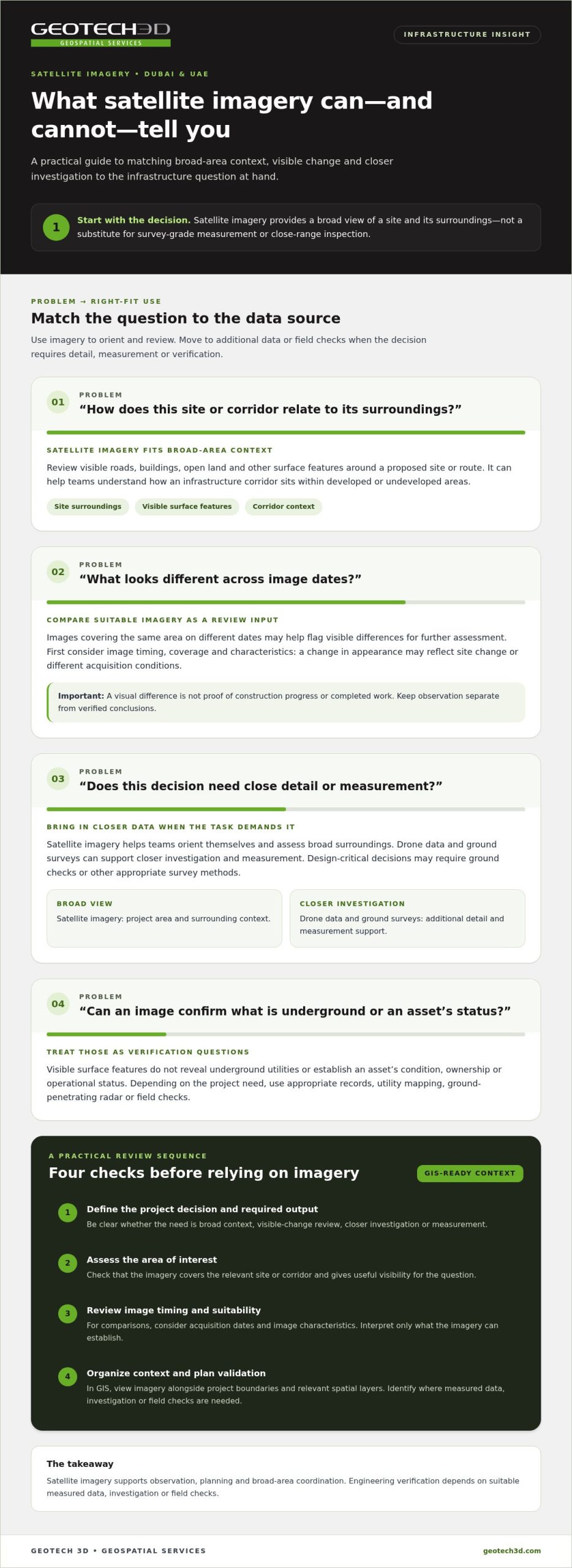
A Practical Workflow for Applying Satellite Imagery to UAE Infrastructure Projects
A useful workflow begins with the project decision, not with the image. For teams in Dubai and across the UAE, this keeps satellite imagery for infrastructure aligned with the work it needs to support, whether that is early site review, visible-change analysis or spatial planning.
Define the project question and imagery requirements
Before selecting imagery, agree on the area of interest, intended use and required outputs. A corridor review may need broad coverage along a route, while a site-context assessment may focus on a defined development area and its surroundings. Record the required timing, output format, accuracy needs and any decisions that will require verification.
Use these steps to shape the work:
- 1. State the decision. Identify whether the team needs site context, a review of visible change or spatial analysis. Make the intended use clear to planners, engineers and project managers.
- 2. Set the area and outputs. Define the project boundary or corridor and specify what the team needs to review, share or incorporate into its mapping workflow.
- 3. Assess imagery suitability. Consider coverage, acquisition timing and visibility in relation to the question. For comparisons over time, determine whether image dates and characteristics allow meaningful review.
- 4. Interpret visible information. Identify relevant surface features and note uncertainties. Keep observations distinct from measured findings, especially where the image alone cannot establish a feature’s position or condition.
- 5. Integrate and validate. Bring the imagery into GIS with suitable project layers, then decide whether the planned use requires complementary data collection, field checks or measured survey.
Interpret, integrate, and validate the imagery
GIS can place imagery in context by organizing it with relevant project boundaries and spatial information. This gives teams a shared view and helps them relate visible features to the project area. Describe what the image shows, identify uncertainty and avoid presenting visual estimates as confirmed measurements.
Validation depends on the decision. Imagery may serve broad planning needs, while design or site decisions requiring more detail may call for complementary survey information or field verification. Establish that distinction before analysis so the final output communicates both the observations and their limits.
Workflow summary: Define the decision, assess suitable imagery, interpret and organize it in GIS, then verify on the ground or with other survey data wherever the project requires measured confirmation.
How GEOTECH 3D Connects Satellite Imagery with Infrastructure Geospatial Workflows
GEOTECH 3D provides high-resolution satellite imagery and aerial mapping for infrastructure projects in Dubai and across the UAE. Start with a defined project question, then use imagery within a broader geospatial workflow. Satellite imagery contributes area-wide context, while GIS & Surveying Services support project mapping and spatial analysis where additional information is needed.
Connecting imagery with GIS and project information
Imagery can be used as a visual layer alongside project boundaries and other spatial information in GIS. This helps teams relate the surrounding area to the project and organize information for review. GEOTECH 3D’s GIS & Surveying Services include Topographic Mapping, Utility Mapping (GPR), Digital Photogrammetry Services and Spatial Analysis. The appropriate inputs depend on the project question and required outputs.
Keep the data sources distinct. Satellite imagery provides a broad visual view; Drone Services provide aerial data for project-specific needs; ground survey supports requirements for measured site information. When the project scope calls for complementary detail, these sources can contribute different information to a coordinated workflow. Imagery alone should not be treated as confirmation of underground assets or survey measurements.
For projects considering how spatial information can support asset management over time, read the Digital Twin for Asset Lifecycle guide. The Geoverse Platform supports city-scale modeling, smart-city management and spatial analysis, extending geospatial workflows beyond an individual site.
Discussing a Dubai or UAE infrastructure project
A useful project brief identifies the project location or corridor, the decision the team needs to make, the intended use of the imagery and the required outputs. Include timing considerations and explain where measured information or field verification may be needed. This helps align satellite imagery for infrastructure with the project’s actual requirements, rather than assuming one data source will answer every question.
If underground assets are relevant, the Subsurface Utility Engineering in Dubai guide provides related context. Utility mapping and other appropriate survey inputs can be considered alongside imagery according to project needs.
Discuss your Dubai or UAE infrastructure requirements with GEOTECH 3D to define suitable geospatial inputs and a project-specific workflow.
Make Geospatial Data Work for Your Infrastructure Decisions
Satellite imagery for infrastructure can give project teams in Dubai and across the UAE a valuable view of site context, surrounding land use and visible change. It is most useful when selected for a defined project question and interpreted within its limits.
Choose data according to the decision: satellite imagery supports broad-area review, while Drone Services and ground surveys can provide complementary information when the project requires closer detail or measured site data. Bringing suitable sources together through GIS helps teams coordinate spatial information without treating visual interpretation as engineering verification.
GEOTECH 3D provides high-resolution satellite imagery and aerial mapping for infrastructure projects. Its GIS & Surveying Services and Geoverse Platform can support wider geospatial workflows, including spatial analysis, city-scale modeling and smart-city management.
Share your project location, intended use and required outputs to start a focused discussion about suitable geospatial inputs.
Matching the data to each decision gives your team a clearer, more coordinated foundation for the work ahead.
Frequently Asked Questions
What is satellite imagery used for in infrastructure projects?
Satellite imagery helps infrastructure teams review a site and its wider surroundings from above. It provides broad-area context for planning, shows visible relationships between a project area and nearby features, and supports spatial analysis when used with relevant GIS layers. For a Dubai transport or utility corridor, imagery can help teams understand surrounding land and visible development before deciding whether more detailed data is needed.
Can satellite imagery monitor infrastructure construction progress?
Satellite imagery can support progress monitoring by helping teams review visible changes between suitable images captured on different dates. It may indicate areas that warrant closer assessment, but an image comparison alone does not prove construction progress, completed work or site conditions. Differences in image timing, coverage and acquisition conditions can affect interpretation. For verified progress information, consider imagery alongside project records, field checks or other suitable survey data.
How accurate is satellite imagery for infrastructure mapping?
There is no single accuracy value that applies to every satellite image or mapping task. Suitability depends on the source data, its characteristics and the accuracy required for the intended use. Imagery may suit broad visual context, while design-critical mapping can require measured survey information or field verification. Define the required output and assess whether the selected data is fit for the purpose before using it for an infrastructure decision.
Is satellite imagery a replacement for drone or ground surveys?
No. Satellite imagery, Drone Services and ground surveys contribute different information. Satellite imagery supports broad-area review; drone data can provide aerial information for project-specific requirements; and ground survey can address needs for measured site information. Infrastructure teams may combine these sources when the project scope calls for complementary detail. Base the choice on the geographic area, intended use and information required, rather than assuming one method suits every task.
What affects the usefulness of satellite imagery for a UAE infrastructure project?
Usefulness depends on whether the imagery matches the project question, area of interest and required outputs. Consider coverage, acquisition timing, visibility and whether images from different dates can be meaningfully compared. A broad view may help with early planning in Dubai, while a focused design question may need additional data. Establish accuracy and verification needs before relying on visual interpretation.
Can satellite imagery show underground utilities?
No. Satellite imagery records visible surface information and does not reveal underground utility locations by itself. Surface features provide context, but do not confirm the presence, position or condition of buried assets. Where underground information is required, use appropriate records, investigation or utility-mapping methods. GEOTECH 3D’s GIS & Surveying Services include Utility Mapping (GPR), which can contribute subsurface information within a project-specific geospatial workflow.
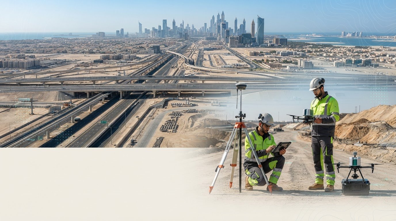
What can satellite imagery reveal about an infrastructure site, and where does its detail stop? For developers, contractors and asset owners, satellite imagery for infrastructure offers a broad view of a project area and its surroundings. It can help teams understand site context and review visible change, but it is not a substitute for survey-grade measurement or close-range inspection.
That distinction matters in Dubai and across the UAE, where project teams may need to assess long corridors, urban growth and surrounding land. The data source should match the decision: satellite imagery can provide broad-area context, while drone data and ground surveys can supply additional detail when the project requires it.
This article explains how satellite imagery can support infrastructure planning and monitoring, how it compares with drone and ground survey data, and how different sources can be organized in GIS or a digital-twin workflow. GEOTECH 3D provides satellite imagery and aerial mapping, GIS & Surveying Services, and the Geoverse Platform for geospatial work in Dubai and the UAE.
Key Takeaways
- Use satellite imagery for infrastructure to review broad site context, surrounding land use and visible relationships between assets.
- Consider imagery for planning and monitoring questions that benefit from a view across corridors or wider project areas.
- Match the data source to the task: satellite imagery provides broad-area context, while drone and ground surveys can support closer investigation and measurement.
- Start with the project decision and required outputs. Then assess the area of interest, image timing, GIS context and validation needs.
- Combine imagery with GIS & Surveying Services and other relevant geospatial data to support coordinated infrastructure workflows in Dubai and the UAE.
What Satellite Imagery for Infrastructure Can Show Across Dubai and the UAE
Satellite imagery is remotely sensed visual data that records the Earth’s surface from above. For infrastructure teams, it offers a broad view of a site and its surroundings, helping place a proposed asset within the built and natural environment. This is the central value of satellite imagery for infrastructure: it establishes context, rather than acting as a measured survey deliverable.
Satellite sensors collect information from a distance, a process described in this overview of remote sensing technology. The resulting imagery can help teams see a project area in relation to visible roads, buildings, open land and other surface features. In Dubai and the wider UAE, this can be useful when reviewing a corridor through developed areas or a site near a mix of urban and undeveloped land.
Which infrastructure questions can satellite imagery help answer?
Imagery can help teams understand what surrounds a project area and how visible infrastructure relates across a broader landscape. It may help answer questions such as:
- What visible land uses and built features surround the proposed site or corridor?
- How does the project area relate to nearby roads, buildings or other surface assets?
- What visible differences appear between images covering the same area on different dates?
Repeat imagery can support a review of visible change when the available data is suitable for comparison. A surface feature may look different without the image explaining why. Keep observations separate from conclusions that require field verification or measured survey data.
What satellite imagery does not establish on its own
An image does not confirm an asset’s condition, ownership or operational status. It also cannot reveal underground utilities simply because surface features are visible. Those questions require appropriate records, investigation or survey methods, such as utility mapping, ground-penetrating radar or field checks, depending on the project need.
Whether imagery is suitable for measurement depends on the source data and the accuracy required for the decision. It can help teams orient themselves and assess broad surroundings, while design-critical decisions may require ground checks or other survey methods. Treating visual interpretation and measured findings as distinct inputs helps teams use each source appropriately.
How Satellite Imagery Supports Infrastructure Planning and Monitoring
Satellite imagery can inform infrastructure decisions when teams need to understand a project area in relation to its surroundings. During planning, it can help frame a corridor or site before more detailed investigation. During monitoring, suitable images from different dates can help identify visible changes for further review. Its value depends on the question and whether the imagery is fit for that purpose.
Using imagery for site context and infrastructure corridors
For a transport, utility or development corridor in Dubai or elsewhere in the UAE, a broad view can help planners assess how the route relates to surrounding development and visible networks. In GIS, imagery can be organized alongside project boundaries and other relevant spatial layers, giving teams a shared reference for discussion. This supports coordination, but it does not independently confirm underground utilities or exact asset positions.
Using imagery to review visible change over time
Comparing images from different dates can help teams review visible change across a project area, provided the coverage and image characteristics make a meaningful comparison possible. A difference in appearance may reflect actual site change, but it may also result from different acquisition conditions or image characteristics. Use the comparison as a planning or monitoring input, not as proof of construction progress or completed work.
In practice, satellite imagery for infrastructure can contribute to several project activities:
- Planning: Review a proposed site or corridor in relation to surrounding development and visible features.
- Coordination: Give project teams a common visual reference for discussing location and context.
- Monitoring: Flag visible differences between suitable image dates for further assessment.
- GIS analysis: View imagery alongside relevant project layers to support spatial review.
Before relying on imagery, assess its acquisition date, coverage, visibility and suitability for the question. An image that gives useful context for a long corridor may not show enough detail for a localized design issue. Interpret only what the imagery can establish. Satellite imagery supports observation and monitoring, while engineering verification depends on appropriate measured data, investigation or field checks.
For infrastructure work requiring broad-area context, GEOTECH 3D provides satellite imagery and aerial mapping as part of project-specific geospatial workflows.
Satellite Imagery vs Drone Surveys and Ground Surveys for Infrastructure
No single data source answers every infrastructure question. Satellite imagery for infrastructure gives teams broad-area context, while Drone Services and ground surveys can provide different types of project-specific detail. Choose based on the geographic scope, the decision to be made and the information required.
Coverage: Satellite imagery offers a view across a wider area. Drone data is suited to focused aerial coverage defined for a project. Ground survey examines locations on site.
Level of detail: Satellite imagery supports visual interpretation based on the selected source. Drone data can add localized aerial detail. Ground survey provides measured site information appropriate to its scope.
Project question: Satellite imagery can help frame site context and surrounding visible features. Drone data can support closer aerial review of a defined area. Ground survey addresses questions that require measurements made on site.
Field verification: Imagery may help identify areas for further review, but it does not verify conditions on the ground. Drone data also has limits tied to the project requirement. Ground checks or measured survey may be needed when decisions depend on verified site information.
When satellite imagery is the appropriate starting point
For early planning in Dubai or elsewhere in the UAE, a broad-area view can help teams understand a proposed site or corridor in relation to nearby development and visible infrastructure. It is a useful starting point when the question concerns surrounding context rather than precise site measurements. The geographic scope matters: a long corridor or extensive area may call for a different data approach than a small, design-critical location.
Also consider the required output, image timing, visibility and coverage. Do not assume that an image is suitable for measurement simply because it is available. Project specifications and intended use determine whether the imagery can support the task.
When drone or ground-based data adds project detail
Drone Services provide a separate source of aerial data for defined project requirements. Ground survey is relevant when teams need measured site information to inform design or verify conditions. These sources can complement satellite imagery: the broad view helps orient the team, while more focused data can address questions requiring greater detail or site measurement.
For example, a team reviewing a corridor may use imagery to understand its wider setting, then apply project-specific aerial or ground data to investigate selected locations. GIS & Surveying Services can help organize spatial information for mapping and analysis, bringing relevant sources into a coordinated view where the project scope calls for it.
Choose the source by starting with the decision, not the technology. This avoids a common mistake: assuming one image or survey method can provide every measurement an infrastructure project requires.
A Practical Workflow for Applying Satellite Imagery to UAE Infrastructure Projects
A useful workflow begins with the project decision, not with the image. For teams in Dubai and across the UAE, this keeps satellite imagery for infrastructure aligned with the work it needs to support, whether that is early site review, visible-change analysis or spatial planning.
Define the project question and imagery requirements
Before selecting imagery, agree on the area of interest, intended use and required outputs. A corridor review may need broad coverage along a route, while a site-context assessment may focus on a defined development area and its surroundings. Record the required timing, output format, accuracy needs and any decisions that will require verification.
Use these steps to shape the work:
- 1. State the decision. Identify whether the team needs site context, a review of visible change or spatial analysis. Make the intended use clear to planners, engineers and project managers.
- 2. Set the area and outputs. Define the project boundary or corridor and specify what the team needs to review, share or incorporate into its mapping workflow.
- 3. Assess imagery suitability. Consider coverage, acquisition timing and visibility in relation to the question. For comparisons over time, determine whether image dates and characteristics allow meaningful review.
- 4. Interpret visible information. Identify relevant surface features and note uncertainties. Keep observations distinct from measured findings, especially where the image alone cannot establish a feature’s position or condition.
- 5. Integrate and validate. Bring the imagery into GIS with suitable project layers, then decide whether the planned use requires complementary data collection, field checks or measured survey.
Interpret, integrate, and validate the imagery
GIS can place imagery in context by organizing it with relevant project boundaries and spatial information. This gives teams a shared view and helps them relate visible features to the project area. Describe what the image shows, identify uncertainty and avoid presenting visual estimates as confirmed measurements.
Validation depends on the decision. Imagery may serve broad planning needs, while design or site decisions requiring more detail may call for complementary survey information or field verification. Establish that distinction before analysis so the final output communicates both the observations and their limits.
Workflow summary: Define the decision, assess suitable imagery, interpret and organize it in GIS, then verify on the ground or with other survey data wherever the project requires measured confirmation.
How GEOTECH 3D Connects Satellite Imagery with Infrastructure Geospatial Workflows
GEOTECH 3D provides high-resolution satellite imagery and aerial mapping for infrastructure projects in Dubai and across the UAE. Start with a defined project question, then use imagery within a broader geospatial workflow. Satellite imagery contributes area-wide context, while GIS & Surveying Services support project mapping and spatial analysis where additional information is needed.
Connecting imagery with GIS and project information
Imagery can be used as a visual layer alongside project boundaries and other spatial information in GIS. This helps teams relate the surrounding area to the project and organize information for review. GEOTECH 3D’s GIS & Surveying Services include Topographic Mapping, Utility Mapping (GPR), Digital Photogrammetry Services and Spatial Analysis. The appropriate inputs depend on the project question and required outputs.
Keep the data sources distinct. Satellite imagery provides a broad visual view; Drone Services provide aerial data for project-specific needs; ground survey supports requirements for measured site information. When the project scope calls for complementary detail, these sources can contribute different information to a coordinated workflow. Imagery alone should not be treated as confirmation of underground assets or survey measurements.
For projects considering how spatial information can support asset management over time, read the Digital Twin for Asset Lifecycle guide. The Geoverse Platform supports city-scale modeling, smart-city management and spatial analysis, extending geospatial workflows beyond an individual site.
Discussing a Dubai or UAE infrastructure project
A useful project brief identifies the project location or corridor, the decision the team needs to make, the intended use of the imagery and the required outputs. Include timing considerations and explain where measured information or field verification may be needed. This helps align satellite imagery for infrastructure with the project’s actual requirements, rather than assuming one data source will answer every question.
If underground assets are relevant, the Subsurface Utility Engineering in Dubai guide provides related context. Utility mapping and other appropriate survey inputs can be considered alongside imagery according to project needs.
Discuss your Dubai or UAE infrastructure requirements with GEOTECH 3D to define suitable geospatial inputs and a project-specific workflow.
Make Geospatial Data Work for Your Infrastructure Decisions
Satellite imagery for infrastructure can give project teams in Dubai and across the UAE a valuable view of site context, surrounding land use and visible change. It is most useful when selected for a defined project question and interpreted within its limits.
Choose data according to the decision: satellite imagery supports broad-area review, while Drone Services and ground surveys can provide complementary information when the project requires closer detail or measured site data. Bringing suitable sources together through GIS helps teams coordinate spatial information without treating visual interpretation as engineering verification.
GEOTECH 3D provides high-resolution satellite imagery and aerial mapping for infrastructure projects. Its GIS & Surveying Services and Geoverse Platform can support wider geospatial workflows, including spatial analysis, city-scale modeling and smart-city management.
Share your project location, intended use and required outputs to start a focused discussion about suitable geospatial inputs.
Matching the data to each decision gives your team a clearer, more coordinated foundation for the work ahead.
Frequently Asked Questions
What is satellite imagery used for in infrastructure projects?
Satellite imagery helps infrastructure teams review a site and its wider surroundings from above. It provides broad-area context for planning, shows visible relationships between a project area and nearby features, and supports spatial analysis when used with relevant GIS layers. For a Dubai transport or utility corridor, imagery can help teams understand surrounding land and visible development before deciding whether more detailed data is needed.
Can satellite imagery monitor infrastructure construction progress?
Satellite imagery can support progress monitoring by helping teams review visible changes between suitable images captured on different dates. It may indicate areas that warrant closer assessment, but an image comparison alone does not prove construction progress, completed work or site conditions. Differences in image timing, coverage and acquisition conditions can affect interpretation. For verified progress information, consider imagery alongside project records, field checks or other suitable survey data.
How accurate is satellite imagery for infrastructure mapping?
There is no single accuracy value that applies to every satellite image or mapping task. Suitability depends on the source data, its characteristics and the accuracy required for the intended use. Imagery may suit broad visual context, while design-critical mapping can require measured survey information or field verification. Define the required output and assess whether the selected data is fit for the purpose before using it for an infrastructure decision.
Is satellite imagery a replacement for drone or ground surveys?
No. Satellite imagery, Drone Services and ground surveys contribute different information. Satellite imagery supports broad-area review; drone data can provide aerial information for project-specific requirements; and ground survey can address needs for measured site information. Infrastructure teams may combine these sources when the project scope calls for complementary detail. Base the choice on the geographic area, intended use and information required, rather than assuming one method suits every task.
What affects the usefulness of satellite imagery for a UAE infrastructure project?
Usefulness depends on whether the imagery matches the project question, area of interest and required outputs. Consider coverage, acquisition timing, visibility and whether images from different dates can be meaningfully compared. A broad view may help with early planning in Dubai, while a focused design question may need additional data. Establish accuracy and verification needs before relying on visual interpretation.
Can satellite imagery show underground utilities?
No. Satellite imagery records visible surface information and does not reveal underground utility locations by itself. Surface features provide context, but do not confirm the presence, position or condition of buried assets. Where underground information is required, use appropriate records, investigation or utility-mapping methods. GEOTECH 3D’s GIS & Surveying Services include Utility Mapping (GPR), which can contribute subsurface information within a project-specific geospatial workflow.
Search Now
Error: Contact form not found.