

Our Services
The Definitive Guide to Smart City 3D Modeling in Dubai (2026)
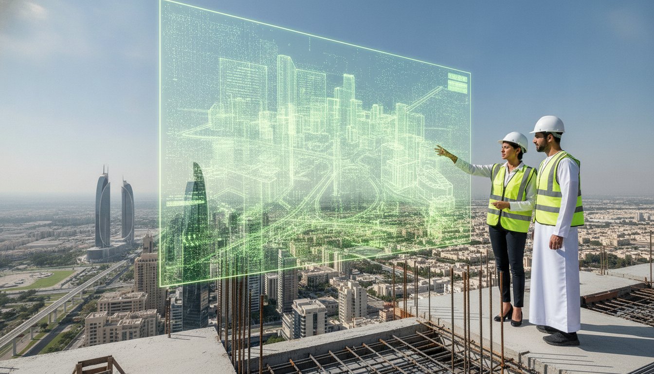
What if your city’s infrastructure didn’t just exist in concrete and steel, but lived as a dynamic, data-rich ecosystem that predicted its own maintenance needs? In the fast-paced development environment of Dubai, the traditional reliance on fragmented data is no longer sufficient for sophisticated smart city 3D modeling. You’ve likely experienced the friction caused by data silos between major infrastructure projects or the risk of relying on inaccurate legacy utility maps. These hurdles often make it nearly impossible to visualize real-time urban growth with the precision required for modern engineering. We understand that as a developer or consultant in the UAE, you need more than just a map; you need a reliable digital foundation.
This guide empowers you to master the complexities of urban-scale digital twins through high-precision geospatial technology. By the year 2026, these models have become the essential geospatial operating system for the Emirates, moving beyond simple visuals into functional urban intelligence. You’ll discover how tools like the Leica RTC 360 and the Geoverse Platform are streamlining asset management and reducing planning errors across the region. We’ll walk through the transition from individual BIM files to a centralized platform that provides total clarity for both existing city structures and future expansions.
Key Takeaways
- Understand how smart city 3D modeling has evolved from static CAD drawings into dynamic, multi-layered geospatial databases that serve as the foundation for Dubai’s urban intelligence.
- Discover the technical advantages of hybrid data acquisition, utilizing Mobile LiDAR and the Geoverse Platform to capture high-precision data at scale.
- Learn how to mitigate project risks by integrating Utility Mapping (GPR) into your city-scale models to ensure accurate sub-surface visualization.
- Master the strategic framework for setting Level of Detail (LOD) requirements and data standards to ensure long-term asset management success.
- Explore why partnering with local experts in Dubai and Abu Dhabi is essential for navigating the complex regulatory and technical landscape of the UAE in 2026.
What is Smart City 3D Modeling in the 2026 Landscape?
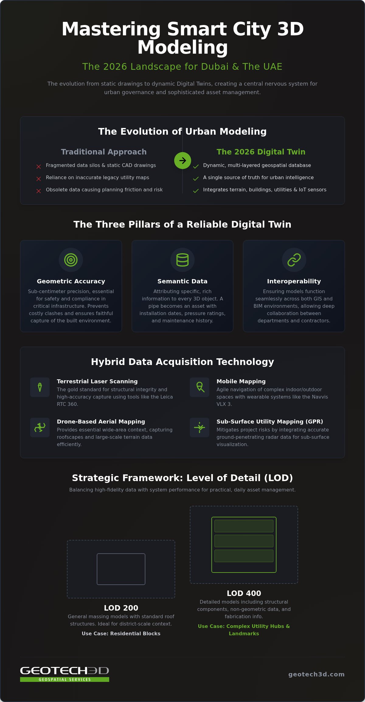
By 2026, smart city 3D modeling has evolved from a niche architectural visualization tool into the central nervous system of urban governance. It’s no longer just a collection of 3D shapes; it’s a sophisticated, multi-layered geospatial database. In Dubai, this shift is driven by a mandate for real-time urban intelligence. We’ve moved far beyond static CAD drawings that quickly become obsolete. Today’s dynamic Digital Twins integrate terrain data, building geometries, sub-surface utilities, and live IoT sensors into a single source of truth. This evolution allows authorities and developers to simulate the impact of new projects before a single shovel hits the ground.
The Core Pillars of a Digital Twin
Reliable urban modeling rests on three critical foundations. First, geometric accuracy is paramount. For critical infrastructure in Abu Dhabi and Dubai, sub-centimeter precision isn’t a luxury; it’s a requirement for safety and compliance. When GEOTECH 3D utilizes the Leica RTC 360, we’re ensuring every millimeter of the built environment is captured faithfully. This level of detail is vital for preventing costly clashes during the construction of complex interchanges or high-rise foundations.
The second pillar is semantic data. This involves attributing specific information to every 3D object in the model. A pipe isn’t just a cylinder; it’s a specific asset with installation dates, pressure ratings, and maintenance history. Finally, interoperability ensures these models function seamlessly across both GIS and BIM environments. This connectivity allows different government departments and private contractors to collaborate without the data silos that previously plagued large-scale UAE projects.
Modeling at Scale: From Building to District
Scaling smart city 3D modeling to cover entire districts presents significant data management hurdles. In 2026, the sheer volume of point cloud data from Mobile LiDAR and drone surveys can overwhelm standard hardware. The Geoverse Platform addresses this by providing a robust environment to host and visualize massive datasets without compromising speed. It enables stakeholders to fly through a digital version of a district as easily as they would a single room.
Managing these large-scale models requires a strategic approach to the Level of Detail (LOD). Not every structure needs the same granularity. We often apply LOD 400 for complex utility hubs or landmark towers while maintaining LOD 200 for residential blocks to preserve system performance. This balance ensures the model remains a practical tool for daily asset management rather than just a heavy visual file. Using advanced tools like the Navvis VLX 3 allows for rapid street-level mapping, feeding these district-scale models with current, high-fidelity data that reflects the rapid pace of UAE development.
Advanced Data Acquisition: The Tech Behind the Model
Precision in 2026 demands a multi-sensor approach. Relying on a single data source often leads to the very silos that hinder effective smart city 3D modeling. We now utilize hybrid data acquisition strategies that synchronize terrestrial, mobile, and aerial sensors into a cohesive dataset. This methodology ensures that every aspect of the urban environment, from the deep utility tunnels beneath Sheikh Zayed Road to the summits of the city’s newest skyscrapers, is captured with absolute fidelity. By combining these technologies, we create a comprehensive urban view that supports both immediate engineering needs and long-term asset management.
Terrestrial and Mobile Laser Scanning
Static scanning remains the gold standard for structural integrity and high-accuracy building capture. The Leica RTC 360 allows our teams to document complex environments at high speeds without sacrificing sub-centimeter precision. It’s particularly effective for capturing the intricate details of historical sites or critical infrastructure hubs. However, the scale of Dubai’s modern districts requires the agility of mobile mapping. We use the Navvis VLX 3, a wearable mobile mapping system, to navigate complex indoor and outdoor urban spaces quickly. This tech is invaluable for capturing ‘over ceiling’ utilities and confined plant rooms that traditional scanners might miss. Integrating these diverse datasets into a unified environment is where professional 3D laser scanning services add the most value to a project.
Drone-Based Aerial Mapping
Aerial data provides the essential context for district-scale models. Using the DJI Zenmuse H20T multi-sensor payload, we capture high-resolution visual and thermal data in a single flight. This multi-layered information is vital for smart building monitoring, allowing developers to identify heat leaks or structural anomalies that aren’t visible to the naked eye. UAV photogrammetry then processes these images to generate massive, city-scale point clouds that serve as the topographical skin of the digital twin.
Safety and compliance are central to every mission we conduct in high-density Dubai districts. Navigating the strict regulations of the Dubai Civil Aviation Authority (DCAA) requires meticulous planning and established expertise. We ensure every flight path is optimized for data density while adhering to the highest safety standards. This disciplined approach guarantees that your smart city 3D modeling project remains on schedule and fully compliant with UAE federal laws. The result is a clean, actionable model that bridges the gap between the physical city and its digital counterpart.
Applications of 3D Models in UAE Urban Planning
Smart city 3D modeling serves as the blueprint for the Emirates’ ambitious urban expansion. In 2026, planners in Dubai and Abu Dhabi use these high-precision models to optimize infrastructure development, ensuring that new transport networks and residential districts integrate perfectly with the existing environment. Beyond simple aesthetics, these models facilitate complex environmental impact studies. For instance, high-resolution terrain models allow engineers to conduct precise water catchment analysis. This is essential for designing resilient drainage systems capable of handling the unique weather patterns seen in the UAE. Additionally, we use these digital records for heritage preservation, creating millimeter-accurate replicas of cultural landmarks to ensure they’re protected for future generations.
Subsurface Utility Engineering (SUE)
The true foundation of any smart city lies beneath the pavement. Mapping the ‘invisible’ city is a critical requirement for any major construction project in Dubai. We utilize Ground Penetrating Radar (GPR) and advanced electromagnetic sensors to integrate subsurface data directly into the urban model. This process prevents costly utility strikes and service disruptions that can derail tight project schedules. By visualizing the exact location of water, power, and telecommunication lines, contractors can excavate with confidence. For a deeper look at these protocols, read our Comprehensive Guide to Subsurface Utility Engineering in Dubai (2026).
Asset Management and Digital Twins
Once construction is complete, the 3D model transitions into a live asset management tool. By integrating the model with the Geoverse Platform, facility managers can monitor building health and energy consumption in real-time. This lifecycle management approach ensures that every structure remains efficient and safe throughout its operational life. The data allows for predictive maintenance, identifying potential failures in HVAC or electrical systems before they occur. This proactive strategy is reshaping how we manage the UAE’s built environment. You can explore this further in our Digital Twin for Asset Lifecycle: Comprehensive 2026 Guide.
A Strategic Framework for Implementing City-Scale Models
Successful implementation of smart city 3D modeling relies on a disciplined methodology rather than just advanced hardware. Before data acquisition begins, we work with stakeholders to define the model’s primary purpose. A model designed for public engagement requires high-fidelity textures, while one intended for infrastructure maintenance demands rigorous Level of Detail (LOD) and attribute accuracy. Establishing these standards early prevents data bloat and ensures the digital twin remains a functional asset for years to come. In the UAE, where urban growth is rapid, these standards provide the necessary consistency across different project phases and multiple contractors.
Defining the Workflow
The process begins with establishing a robust geodetic control network. This foundational step ensures all geospatial data aligns perfectly with the UAE National Grid, providing a reliable spatial reference for every sensor used. Following this, we execute multi-sensor data acquisition. This stage involves deploying LiDAR, Drone photogrammetry, and GPR to capture every urban layer simultaneously. Finally, we move to point cloud processing and feature extraction. Raw data is cleaned, filtered, and converted into intelligent, navigable 3D geometry that serves as the base for the digital twin.
From Raw Data to BIM-Ready Models
Transforming point clouds into actionable intelligence often requires a Scan-to-BIM approach. This bridge is vital for existing structures where legacy drawings are missing or inaccurate. We integrate these models with real estate strata mapping to ensure full compliance with Dubai’s latest land department regulations. This integration allows for precise ownership records and asset boundaries within the 3D environment, which is essential for mixed-use developments and high-rise towers. Each model undergoes final validation to ensure it meets the specific interoperability needs of your GIS or BIM ecosystem.
Data security remains a top priority for our UAE clients. All hosted models on the Geoverse Platform adhere to local data residency requirements, ensuring that sensitive infrastructure information remains secure and accessible only to authorized personnel. Hosting considerations in the UAE involve more than just server space; it’s about maintaining a centralized urban intelligence platform that can be accessed by diverse teams while protecting sovereign data. Our collaborative workflows ensure that the transition from raw scans to a BIM-ready model is seamless, reducing planning errors and enhancing asset management for existing city structures.
GEOTECH 3D: Your Partner in Smart City Evolution
GEOTECH 3D functions as a strategic partner for the UAE’s urban development, bringing established expertise to every smart city 3D modeling project. We understand the unique challenges of the Middle East market and operate from dedicated offices in Dubai and Abu Dhabi. This local presence ensures we’re always available for site visits, stakeholder meetings, and face-to-face consultations. We don’t simply provide data; we offer a collaborative alliance designed to move your project from a conceptual vision to a functional reality. Our commitment to precision and integrity means you can rely on us to meet tight schedules while maintaining the highest technical standards in the region.
Localized Expertise and Safety
Compliance in the UAE requires a deep understanding of local standards and federal regulations. We’ve spent decades refining our workflows to meet the requirements of the Dubai Municipality and the RTA. This specialized knowledge is vital for project success in high-density urban zones. We prioritize safety at every level, implementing protocols that exceed industry norms for the oil & gas sector. Contact our Dubai office at +971 4 295 1589 for a professional consultation.
Future-Proofing Your Assets
The urban landscape of 2026 is dynamic, and your data should be too. We provide scalable models that grow alongside your district, ensuring your smart city 3D modeling investment remains valuable. Our deliverables are BIM-ready and compatible with all major CAD packages for seamless integration. The Geoverse Platform serves as the ultimate unified environment for UAE smart city data, simplifying lifecycle management for existing structures. Request a demo of the Geoverse Platform today.
By choosing GEOTECH 3D, you’re choosing a faithful guide with the wisdom of experience and the energy of an innovator. We provide end-to-end geospatial solutions tailored specifically for the unique environment of the Emirates, from initial topo surveys to complex digital twins. Whether you’re managing a single high-rise asset or an entire smart district, our tools ensure you have the urban intelligence needed to succeed. We take pride in our ability to empower clients with precise data, helping them navigate technical complexities with absolute confidence and security.
Building the Digital Future of the Emirates
The landscape of urban development in Dubai is undergoing a profound transformation. By 2026, smart city 3D modeling has become the indispensable foundation for managing complex infrastructure and ensuring long-term sustainability. We’ve explored how the integration of terrestrial scanning, mobile mapping, and aerial data creates a unified urban intelligence platform. This methodology eliminates data silos and provides the clarity needed for both asset maintenance and new planning.
GEOTECH 3D stands as a leading specialist in high-precision 3D scanning, licensed and registered across the Middle East to provide reliable geospatial support. By utilizing state-of-the-art tech like the Navvis VLX 3 and Leica RTC 360, we ensure your projects are grounded in absolute accuracy. Our team is ready to help you navigate the technical and regulatory requirements of the UAE market with confidence.
Embracing these advanced modeling standards today secures the resilience of your assets for the decades ahead. We look forward to being your partner in this technological evolution.
Frequently Asked Questions
What is the difference between a 3D city model and a Digital Twin?
A 3D city model is a geometric representation of the urban environment, while a Digital Twin is a dynamic system that integrates real-time data. In the context of smart city 3D modeling, the Digital Twin uses the Geoverse Platform to connect static geometry with live sensor feeds and asset information. This allows for predictive maintenance and real-time monitoring, moving beyond simple visualization to functional urban management.
How accurate is smart city 3D modeling compared to traditional surveys?
High-precision urban modeling provides significantly higher data density and accuracy than traditional point-by-point surveys. Using advanced terrestrial scanners like the Leica RTC 360, we achieve sub-centimeter precision across complex structures. While traditional methods are useful for basic boundaries, 3D laser scanning captures millions of points to create a comprehensive digital record. This level of detail is essential for preventing clashes in dense Dubai infrastructure projects.
What hardware does GEOTECH 3D use for urban-scale data capture?
GEOTECH 3D utilizes a state-of-the-art fleet of sensors tailored for diverse environments. We deploy the Navvis VLX 3 for rapid mobile mapping of indoor and outdoor spaces and the Leica RTC 360 for high-precision static scans. For aerial data, we use drones equipped with the DJI Zenmuse H20T multi-sensor payload. These tools allow our teams to capture comprehensive datasets that serve as the foundation for high-fidelity urban models.
Can 3D models include underground utility data in Dubai?
Yes, our models integrate subsurface utility engineering (SUE) data to provide a complete view of the urban environment. By using Ground Penetrating Radar (GPR) and electromagnetic locators, we map water, power, and telecommunication lines beneath the surface. This data is then layered into the smart city 3D modeling environment. It’s a critical step for preventing utility strikes during excavation in busy districts like Al Qusais or Downtown Dubai.
How long does it take to create a 3D model of a city district?
The timeline depends on the district’s size and the required Level of Detail (LOD). A standard urban block might take a few days for data acquisition using mobile LiDAR, followed by several weeks for processing and feature extraction. Larger districts require more extensive drone and terrestrial coordination. We focus on meeting tight schedules by using rapid capture technologies like the Navvis VLX 3 to streamline the initial survey phase.
Is the Geoverse Platform compatible with existing BIM software?
The Geoverse Platform is designed for high interoperability with industry-standard software. It’s built to deliver BIM-ready models and point cloud data that integrate seamlessly with major CAD and GIS packages. This ensures that the data we provide is immediately actionable for your engineering and design teams. Our end-to-end solutions bridge the gap between raw field data and the sophisticated modeling environments used by UAE consultants.
What are the regulatory requirements for drone surveying in the UAE?
Drone operations in the UAE require strict adherence to regulations set by the Dubai Civil Aviation Authority (DCAA) or the General Civil Aviation Authority (GCAA). Operators must be licensed, and each flight requires specific permits, especially in high-density areas. GEOTECH 3D manages the entire compliance process, ensuring all aerial surveys are conducted safely and legally. This includes obtaining necessary approvals for thermal inspections and large-scale topographic mapping.
How often should a smart city 3D model be updated?
Update frequency depends on the pace of development and the model’s primary use. For rapidly evolving areas in Dubai, we recommend annual updates or project-specific refreshes after major construction milestones. For asset management, real-time data integration via the Geoverse Platform reduces the need for frequent full-scale re-surveys. Keeping the model current ensures it remains a reliable source of truth for maintenance, planning, and emergency response across the Emirates.
What if your city’s infrastructure didn’t just exist in concrete and steel, but lived as a dynamic, data-rich ecosystem that predicted its own maintenance needs? In the fast-paced development environment of Dubai, the traditional reliance on fragmented data is no longer sufficient for sophisticated smart city 3D modeling. You’ve likely experienced the friction caused by data silos between major infrastructure projects or the risk of relying on inaccurate legacy utility maps. These hurdles often make it nearly impossible to visualize real-time urban growth with the precision required for modern engineering. We understand that as a developer or consultant in the UAE, you need more than just a map; you need a reliable digital foundation.
This guide empowers you to master the complexities of urban-scale digital twins through high-precision geospatial technology. By the year 2026, these models have become the essential geospatial operating system for the Emirates, moving beyond simple visuals into functional urban intelligence. You’ll discover how tools like the Leica RTC 360 and the Geoverse Platform are streamlining asset management and reducing planning errors across the region. We’ll walk through the transition from individual BIM files to a centralized platform that provides total clarity for both existing city structures and future expansions.
Key Takeaways
- Understand how smart city 3D modeling has evolved from static CAD drawings into dynamic, multi-layered geospatial databases that serve as the foundation for Dubai’s urban intelligence.
- Discover the technical advantages of hybrid data acquisition, utilizing Mobile LiDAR and the Geoverse Platform to capture high-precision data at scale.
- Learn how to mitigate project risks by integrating Utility Mapping (GPR) into your city-scale models to ensure accurate sub-surface visualization.
- Master the strategic framework for setting Level of Detail (LOD) requirements and data standards to ensure long-term asset management success.
- Explore why partnering with local experts in Dubai and Abu Dhabi is essential for navigating the complex regulatory and technical landscape of the UAE in 2026.
What is Smart City 3D Modeling in the 2026 Landscape?
By 2026, smart city 3D modeling has evolved from a niche architectural visualization tool into the central nervous system of urban governance. It’s no longer just a collection of 3D shapes; it’s a sophisticated, multi-layered geospatial database. In Dubai, this shift is driven by a mandate for real-time urban intelligence. We’ve moved far beyond static CAD drawings that quickly become obsolete. Today’s dynamic Digital Twins integrate terrain data, building geometries, sub-surface utilities, and live IoT sensors into a single source of truth. This evolution allows authorities and developers to simulate the impact of new projects before a single shovel hits the ground.
The Core Pillars of a Digital Twin
Reliable urban modeling rests on three critical foundations. First, geometric accuracy is paramount. For critical infrastructure in Abu Dhabi and Dubai, sub-centimeter precision isn’t a luxury; it’s a requirement for safety and compliance. When GEOTECH 3D utilizes the Leica RTC 360, we’re ensuring every millimeter of the built environment is captured faithfully. This level of detail is vital for preventing costly clashes during the construction of complex interchanges or high-rise foundations.
The second pillar is semantic data. This involves attributing specific information to every 3D object in the model. A pipe isn’t just a cylinder; it’s a specific asset with installation dates, pressure ratings, and maintenance history. Finally, interoperability ensures these models function seamlessly across both GIS and BIM environments. This connectivity allows different government departments and private contractors to collaborate without the data silos that previously plagued large-scale UAE projects.
Modeling at Scale: From Building to District
Scaling smart city 3D modeling to cover entire districts presents significant data management hurdles. In 2026, the sheer volume of point cloud data from Mobile LiDAR and drone surveys can overwhelm standard hardware. The Geoverse Platform addresses this by providing a robust environment to host and visualize massive datasets without compromising speed. It enables stakeholders to fly through a digital version of a district as easily as they would a single room.
Managing these large-scale models requires a strategic approach to the Level of Detail (LOD). Not every structure needs the same granularity. We often apply LOD 400 for complex utility hubs or landmark towers while maintaining LOD 200 for residential blocks to preserve system performance. This balance ensures the model remains a practical tool for daily asset management rather than just a heavy visual file. Using advanced tools like the Navvis VLX 3 allows for rapid street-level mapping, feeding these district-scale models with current, high-fidelity data that reflects the rapid pace of UAE development.
Advanced Data Acquisition: The Tech Behind the Model
Precision in 2026 demands a multi-sensor approach. Relying on a single data source often leads to the very silos that hinder effective smart city 3D modeling. We now utilize hybrid data acquisition strategies that synchronize terrestrial, mobile, and aerial sensors into a cohesive dataset. This methodology ensures that every aspect of the urban environment, from the deep utility tunnels beneath Sheikh Zayed Road to the summits of the city’s newest skyscrapers, is captured with absolute fidelity. By combining these technologies, we create a comprehensive urban view that supports both immediate engineering needs and long-term asset management.
Terrestrial and Mobile Laser Scanning
Static scanning remains the gold standard for structural integrity and high-accuracy building capture. The Leica RTC 360 allows our teams to document complex environments at high speeds without sacrificing sub-centimeter precision. It’s particularly effective for capturing the intricate details of historical sites or critical infrastructure hubs. However, the scale of Dubai’s modern districts requires the agility of mobile mapping. We use the Navvis VLX 3, a wearable mobile mapping system, to navigate complex indoor and outdoor urban spaces quickly. This tech is invaluable for capturing ‘over ceiling’ utilities and confined plant rooms that traditional scanners might miss. Integrating these diverse datasets into a unified environment is where professional 3D laser scanning services add the most value to a project.
Drone-Based Aerial Mapping
Aerial data provides the essential context for district-scale models. Using the DJI Zenmuse H20T multi-sensor payload, we capture high-resolution visual and thermal data in a single flight. This multi-layered information is vital for smart building monitoring, allowing developers to identify heat leaks or structural anomalies that aren’t visible to the naked eye. UAV photogrammetry then processes these images to generate massive, city-scale point clouds that serve as the topographical skin of the digital twin.
Safety and compliance are central to every mission we conduct in high-density Dubai districts. Navigating the strict regulations of the Dubai Civil Aviation Authority (DCAA) requires meticulous planning and established expertise. We ensure every flight path is optimized for data density while adhering to the highest safety standards. This disciplined approach guarantees that your smart city 3D modeling project remains on schedule and fully compliant with UAE federal laws. The result is a clean, actionable model that bridges the gap between the physical city and its digital counterpart.
Applications of 3D Models in UAE Urban Planning
Smart city 3D modeling serves as the blueprint for the Emirates’ ambitious urban expansion. In 2026, planners in Dubai and Abu Dhabi use these high-precision models to optimize infrastructure development, ensuring that new transport networks and residential districts integrate perfectly with the existing environment. Beyond simple aesthetics, these models facilitate complex environmental impact studies. For instance, high-resolution terrain models allow engineers to conduct precise water catchment analysis. This is essential for designing resilient drainage systems capable of handling the unique weather patterns seen in the UAE. Additionally, we use these digital records for heritage preservation, creating millimeter-accurate replicas of cultural landmarks to ensure they’re protected for future generations.
Subsurface Utility Engineering (SUE)
The true foundation of any smart city lies beneath the pavement. Mapping the ‘invisible’ city is a critical requirement for any major construction project in Dubai. We utilize Ground Penetrating Radar (GPR) and advanced electromagnetic sensors to integrate subsurface data directly into the urban model. This process prevents costly utility strikes and service disruptions that can derail tight project schedules. By visualizing the exact location of water, power, and telecommunication lines, contractors can excavate with confidence. For a deeper look at these protocols, read our Comprehensive Guide to Subsurface Utility Engineering in Dubai (2026).
Asset Management and Digital Twins
Once construction is complete, the 3D model transitions into a live asset management tool. By integrating the model with the Geoverse Platform, facility managers can monitor building health and energy consumption in real-time. This lifecycle management approach ensures that every structure remains efficient and safe throughout its operational life. The data allows for predictive maintenance, identifying potential failures in HVAC or electrical systems before they occur. This proactive strategy is reshaping how we manage the UAE’s built environment. You can explore this further in our Digital Twin for Asset Lifecycle: Comprehensive 2026 Guide.
A Strategic Framework for Implementing City-Scale Models
Successful implementation of smart city 3D modeling relies on a disciplined methodology rather than just advanced hardware. Before data acquisition begins, we work with stakeholders to define the model’s primary purpose. A model designed for public engagement requires high-fidelity textures, while one intended for infrastructure maintenance demands rigorous Level of Detail (LOD) and attribute accuracy. Establishing these standards early prevents data bloat and ensures the digital twin remains a functional asset for years to come. In the UAE, where urban growth is rapid, these standards provide the necessary consistency across different project phases and multiple contractors.
Defining the Workflow
The process begins with establishing a robust geodetic control network. This foundational step ensures all geospatial data aligns perfectly with the UAE National Grid, providing a reliable spatial reference for every sensor used. Following this, we execute multi-sensor data acquisition. This stage involves deploying LiDAR, Drone photogrammetry, and GPR to capture every urban layer simultaneously. Finally, we move to point cloud processing and feature extraction. Raw data is cleaned, filtered, and converted into intelligent, navigable 3D geometry that serves as the base for the digital twin.
From Raw Data to BIM-Ready Models
Transforming point clouds into actionable intelligence often requires a Scan-to-BIM approach. This bridge is vital for existing structures where legacy drawings are missing or inaccurate. We integrate these models with real estate strata mapping to ensure full compliance with Dubai’s latest land department regulations. This integration allows for precise ownership records and asset boundaries within the 3D environment, which is essential for mixed-use developments and high-rise towers. Each model undergoes final validation to ensure it meets the specific interoperability needs of your GIS or BIM ecosystem.
Data security remains a top priority for our UAE clients. All hosted models on the Geoverse Platform adhere to local data residency requirements, ensuring that sensitive infrastructure information remains secure and accessible only to authorized personnel. Hosting considerations in the UAE involve more than just server space; it’s about maintaining a centralized urban intelligence platform that can be accessed by diverse teams while protecting sovereign data. Our collaborative workflows ensure that the transition from raw scans to a BIM-ready model is seamless, reducing planning errors and enhancing asset management for existing city structures.
GEOTECH 3D: Your Partner in Smart City Evolution
GEOTECH 3D functions as a strategic partner for the UAE’s urban development, bringing established expertise to every smart city 3D modeling project. We understand the unique challenges of the Middle East market and operate from dedicated offices in Dubai and Abu Dhabi. This local presence ensures we’re always available for site visits, stakeholder meetings, and face-to-face consultations. We don’t simply provide data; we offer a collaborative alliance designed to move your project from a conceptual vision to a functional reality. Our commitment to precision and integrity means you can rely on us to meet tight schedules while maintaining the highest technical standards in the region.
Localized Expertise and Safety
Compliance in the UAE requires a deep understanding of local standards and federal regulations. We’ve spent decades refining our workflows to meet the requirements of the Dubai Municipality and the RTA. This specialized knowledge is vital for project success in high-density urban zones. We prioritize safety at every level, implementing protocols that exceed industry norms for the oil & gas sector. Contact our Dubai office at +971 4 295 1589 for a professional consultation.
Future-Proofing Your Assets
The urban landscape of 2026 is dynamic, and your data should be too. We provide scalable models that grow alongside your district, ensuring your smart city 3D modeling investment remains valuable. Our deliverables are BIM-ready and compatible with all major CAD packages for seamless integration. The Geoverse Platform serves as the ultimate unified environment for UAE smart city data, simplifying lifecycle management for existing structures. Request a demo of the Geoverse Platform today.
By choosing GEOTECH 3D, you’re choosing a faithful guide with the wisdom of experience and the energy of an innovator. We provide end-to-end geospatial solutions tailored specifically for the unique environment of the Emirates, from initial topo surveys to complex digital twins. Whether you’re managing a single high-rise asset or an entire smart district, our tools ensure you have the urban intelligence needed to succeed. We take pride in our ability to empower clients with precise data, helping them navigate technical complexities with absolute confidence and security.
Building the Digital Future of the Emirates
The landscape of urban development in Dubai is undergoing a profound transformation. By 2026, smart city 3D modeling has become the indispensable foundation for managing complex infrastructure and ensuring long-term sustainability. We’ve explored how the integration of terrestrial scanning, mobile mapping, and aerial data creates a unified urban intelligence platform. This methodology eliminates data silos and provides the clarity needed for both asset maintenance and new planning.
GEOTECH 3D stands as a leading specialist in high-precision 3D scanning, licensed and registered across the Middle East to provide reliable geospatial support. By utilizing state-of-the-art tech like the Navvis VLX 3 and Leica RTC 360, we ensure your projects are grounded in absolute accuracy. Our team is ready to help you navigate the technical and regulatory requirements of the UAE market with confidence.
Embracing these advanced modeling standards today secures the resilience of your assets for the decades ahead. We look forward to being your partner in this technological evolution.
Frequently Asked Questions
What is the difference between a 3D city model and a Digital Twin?
A 3D city model is a geometric representation of the urban environment, while a Digital Twin is a dynamic system that integrates real-time data. In the context of smart city 3D modeling, the Digital Twin uses the Geoverse Platform to connect static geometry with live sensor feeds and asset information. This allows for predictive maintenance and real-time monitoring, moving beyond simple visualization to functional urban management.
How accurate is smart city 3D modeling compared to traditional surveys?
High-precision urban modeling provides significantly higher data density and accuracy than traditional point-by-point surveys. Using advanced terrestrial scanners like the Leica RTC 360, we achieve sub-centimeter precision across complex structures. While traditional methods are useful for basic boundaries, 3D laser scanning captures millions of points to create a comprehensive digital record. This level of detail is essential for preventing clashes in dense Dubai infrastructure projects.
What hardware does GEOTECH 3D use for urban-scale data capture?
GEOTECH 3D utilizes a state-of-the-art fleet of sensors tailored for diverse environments. We deploy the Navvis VLX 3 for rapid mobile mapping of indoor and outdoor spaces and the Leica RTC 360 for high-precision static scans. For aerial data, we use drones equipped with the DJI Zenmuse H20T multi-sensor payload. These tools allow our teams to capture comprehensive datasets that serve as the foundation for high-fidelity urban models.
Can 3D models include underground utility data in Dubai?
Yes, our models integrate subsurface utility engineering (SUE) data to provide a complete view of the urban environment. By using Ground Penetrating Radar (GPR) and electromagnetic locators, we map water, power, and telecommunication lines beneath the surface. This data is then layered into the smart city 3D modeling environment. It’s a critical step for preventing utility strikes during excavation in busy districts like Al Qusais or Downtown Dubai.
How long does it take to create a 3D model of a city district?
The timeline depends on the district’s size and the required Level of Detail (LOD). A standard urban block might take a few days for data acquisition using mobile LiDAR, followed by several weeks for processing and feature extraction. Larger districts require more extensive drone and terrestrial coordination. We focus on meeting tight schedules by using rapid capture technologies like the Navvis VLX 3 to streamline the initial survey phase.
Is the Geoverse Platform compatible with existing BIM software?
The Geoverse Platform is designed for high interoperability with industry-standard software. It’s built to deliver BIM-ready models and point cloud data that integrate seamlessly with major CAD and GIS packages. This ensures that the data we provide is immediately actionable for your engineering and design teams. Our end-to-end solutions bridge the gap between raw field data and the sophisticated modeling environments used by UAE consultants.
What are the regulatory requirements for drone surveying in the UAE?
Drone operations in the UAE require strict adherence to regulations set by the Dubai Civil Aviation Authority (DCAA) or the General Civil Aviation Authority (GCAA). Operators must be licensed, and each flight requires specific permits, especially in high-density areas. GEOTECH 3D manages the entire compliance process, ensuring all aerial surveys are conducted safely and legally. This includes obtaining necessary approvals for thermal inspections and large-scale topographic mapping.
How often should a smart city 3D model be updated?
Update frequency depends on the pace of development and the model’s primary use. For rapidly evolving areas in Dubai, we recommend annual updates or project-specific refreshes after major construction milestones. For asset management, real-time data integration via the Geoverse Platform reduces the need for frequent full-scale re-surveys. Keeping the model current ensures it remains a reliable source of truth for maintenance, planning, and emergency response across the Emirates.
Search Now
Error: Contact form not found.