
Our Services
Utility Mapping
GEOTECH3D provides Utility mapping services with an all-inclusive solution for spatial data management to government and industrial organizations to help your organization efficiently develop and manage your Utility mapping (GPR) related requirements.
GEOTECH3D complex Utility mapping services include utilities like pipework, Road Investigation, Bedrock Mapping, or wires buried underground. It’s a vital part of the civil engineering process, saving time and money on costly reparative work and delays caused by striking utilities.


Ground Penetrating Radar (GPR)
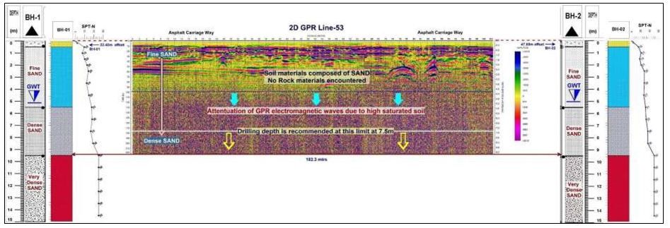
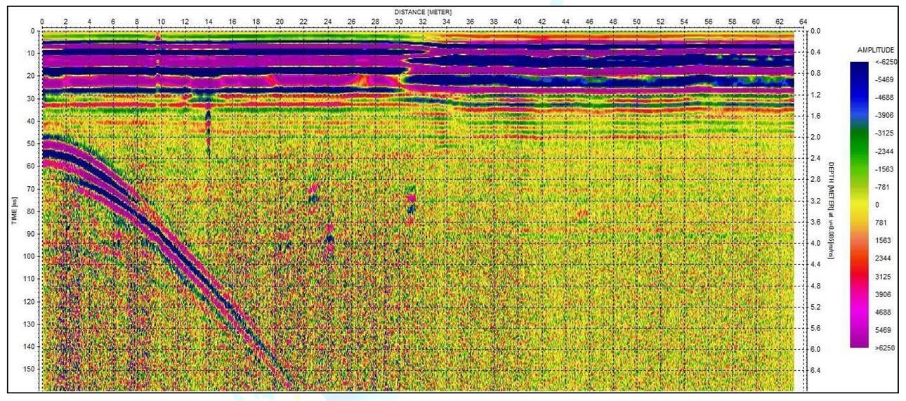
GPR is the method of choice for utility mapping. It emits directional electromagnetic waves in the MHz and GHz frequency range and uses the signal return to identify where sub surface utility infrastructure is located.
GEOTECH3D uses updated technology, and qualified staff to create utility maps, and products. our systems.
GPR Survey technology is highly accurate, and it can locate both metallic and non-metallic utilities. Surveyors tend to prefer using GPR to conduct utility mapping surveys as it offers
- Rapid data acquisition
- Low operation cost
- High-resolution imagery
Search Now
Error: Contact form not found.